


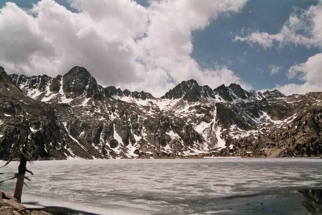
Die Tour beginnt in Espot und führt durch das Tal des Riu Peguera zu den Hochgebirgsseen Estany Tort de Peguera und Estany Negre. Am Estany Tort de Peguera liegt direkt am See die hübsche Refugio Josip Maria Blanc.
Von Espot führt die Strecke dem GR11 - 20 immer im Tal entlang bergan. Der Rückweg ist der gleiche, doch besteht auch die Möglichkeit den Rückweg über einen Forstweg zurück ins Tal nach Espot zu gelangen.
Als Karte bietet sich die "Mapa topogràfic de Catalunya - Parc National d'Aiguestortes i Estany de Sant Maurici" im Maßstab 1:25000 an.
Tour gallery


Tour map and elevation profile
Minimum height 1319 m
Maximum height 2343 m
More about the tour author
|
|
msdetroit |
Comments

GPS tracks
Trackpoints-
GPX / Garmin Map Source (gpx) download
-
TCX / Garmin Training Center® (tcx) download
-
CRS / Garmin Training Center® (crs) download
-
Google Earth (kml) download
-
G7ToWin (g7t) download
-
TTQV (trk) download
-
Overlay (ovl) download
-
Fugawi (txt) download
-
Kompass (DAV) Track (tk) download
-
Track data sheet (pdf) download
-
Original file of the author (gpx) download
More about the tour author
|
|
msdetroit |
Add to my favorites
Remove from my favorites
Edit tags
Open track
My score
Rate