
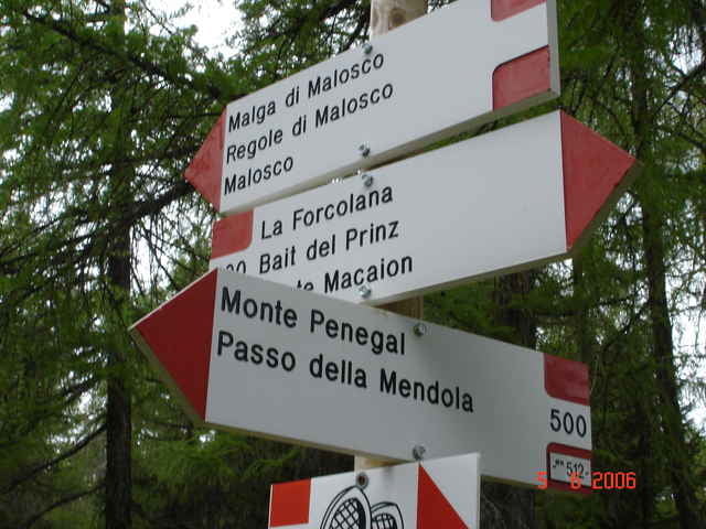

Eppan/St. Michael-Mendelpassstrasse-Mendelpass-Ri Ruffre bis Hotel Paradiso-Weg 514 über Regole bis Bait del Prinz (verfallen)- Weg 512 über Forcolana zum Penegal (hier muss zu 85% geschoben werden)-Mendelpass und zurück nach Eppan.
Hinweis: Wenn man die Strecke, am Mendelpass angelangt, in Gegenuhrzeigerrichtung angeht, ist das genannte Teilstück zu 2/3 fahrbar.
Hinweis: Wenn man die Strecke, am Mendelpass angelangt, in Gegenuhrzeigerrichtung angeht, ist das genannte Teilstück zu 2/3 fahrbar.
Tour map and elevation profile
Minimum height 413 m
Maximum height 1734 m
More about the tour author

|
JV |
Comments

Reschenpass - Meran - Bozen, Autobahn an der Ausfahrt Appiano/St. Michele verlassen
GPS tracks
Trackpoints-
GPX / Garmin Map Source (gpx) download
-
TCX / Garmin Training Center® (tcx) download
-
CRS / Garmin Training Center® (crs) download
-
Google Earth (kml) download
-
G7ToWin (g7t) download
-
TTQV (trk) download
-
Overlay (ovl) download
-
Fugawi (txt) download
-
Kompass (DAV) Track (tk) download
-
Track data sheet (pdf) download
-
Original file of the author (gpx) download
More about the tour author
|
|
JV |
Add to my favorites
Remove from my favorites
Edit tags
Open track
My score
Rate