


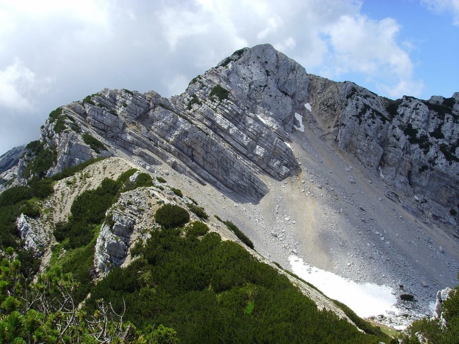
Sehr schwere Bergtour durch hochalpines Gelände von der Gipfelstation des Monte Baldo (1738 m) zur Cima Valdritta (2218 m) und dann Abstieg zur Mittelstation der Seilbahn.
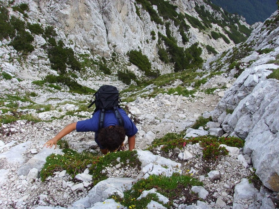
Hierbei müssen ca. 800 Hm bergauf und ca. 1700 Hm bergab in teils sehr ausgesetztem Gelände welches mit vielen Stufen und losem Geröll überseht ist überwunden werden!
Die Tour ist nur für absolut trittsichere und schwindelfreie Personen geeignet !
Der Track läuft bei Abstieg vom Cima Valdritta kurz teilweise neben dem Wanderweg,da aufgrund von Schneefeldern eine Begehung des Weges nicht möglich war.
Auf der ganzen Tour gibt es keine Verpflegungsmöglichkeit.
Unter der Zeitangabe ist die reine Gehzeit ohne Pausen angegeben.
Further information at
http://www.funiviedelbaldo.it/ger/seilbahn_malcesine.aspTour gallery

Tour map and elevation profile
Minimum height 585 m
Maximum height 2215 m
More about the tour author
|
|
blautalbiker |
Comments

Die Talstation befindet sich in Malcesine und ist (Beschildert) leicht zu finden.
GPS tracks
Trackpoints-
GPX / Garmin Map Source (gpx) download
-
TCX / Garmin Training Center® (tcx) download
-
CRS / Garmin Training Center® (crs) download
-
Google Earth (kml) download
-
G7ToWin (g7t) download
-
TTQV (trk) download
-
Overlay (ovl) download
-
Fugawi (txt) download
-
Kompass (DAV) Track (tk) download
-
Track data sheet (pdf) download
-
Original file of the author (gpx) download
More about the tour author
|
|
blautalbiker |
Add to my favorites
Remove from my favorites
Edit tags
Open track
My score
Rate