


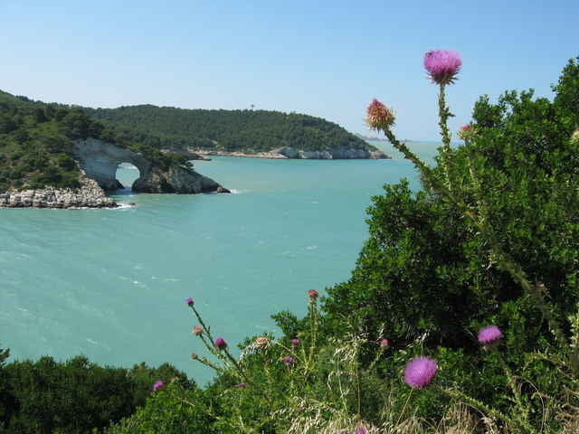
Super Tour durch Olivenhaine, anschließend mit leichter, jedoch 16 km langen Steigung zur Paßhöhe. Steile Abfahrt durch almenähnliches Gelände auf die Küstenstrasse ( schöner Kiosk für eine Pause! ).Zurück zum Ausgangspunkt auf der Küstenstrasse mit herrlichen Ausblicken auf die Küste mit seinen Felsformationen. Insgesamt eine sehr schöne,aber anstrengende Tour, für die man sich Zeit nehmen sollte.
Tour gallery
Tour map and elevation profile
Minimum height 3 m
Maximum height 632 m
More about the tour author

|
Elias Laar |
Comments

Walter Ehgartner
on 17.07.2009
Ist eigentlich eine Tour für das Rennrad. Alles auf Asphaltsrasse.

Beginn an der Küstenstrasse von Vieste nach Peschici (Ca. 8 km nach Vieste), am Abzweig zur Strasse zum Foresta Umbra, oder irgendwo an der Küstenstrasse westlich von Vieste.
GPS tracks
Trackpoints-
GPX / Garmin Map Source (gpx) download
-
TCX / Garmin Training Center® (tcx) download
-
CRS / Garmin Training Center® (crs) download
-
Google Earth (kml) download
-
G7ToWin (g7t) download
-
TTQV (trk) download
-
Overlay (ovl) download
-
Fugawi (txt) download
-
Kompass (DAV) Track (tk) download
-
Track data sheet (pdf) download
-
Original file of the author (g7t) download
More about the tour author
|
|
Elias Laar |
Add to my favorites
Remove from my favorites
Edit tags
Open track
My score
Rate