


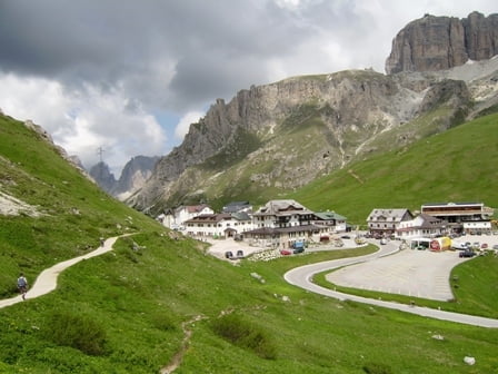
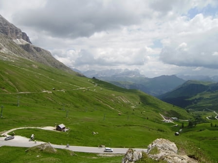
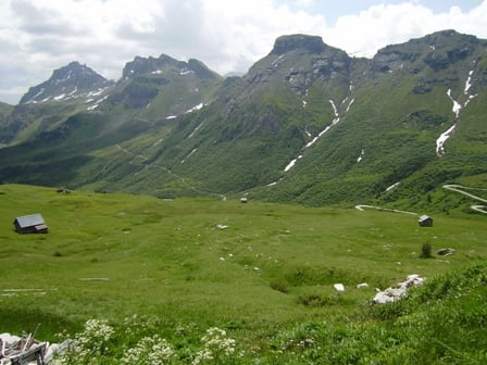
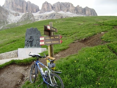
Wir starten im Fassatal - Campitello - Hotel Salvan. Es geht leicht steigend nach Canazei. Dann die asphaltierte Pass-Strasse hinauf. Nach ca. 45 Min erreichen wir "Lupo Bianco". Bald danach kommt der Abzweig zum Sellajoch. Wir fahren rechts weiter hinauf zum Pordoijoch. Lässt sich alles gut fahren. Auf dem Pass angelangt geht es zunächst rechts den Wanderweg hinauf zur Kapelle. Wieder hinab zum Pass. Danach fahren wir zum Kriegerdenkmal hinüber. Nach dem Gedenken hat man herrliche Aussicht auf den Padonkamm und die Ampezzaner Dolomiten. Wir fahren die Strecke wieder zurück und werden diesmal die Tour in Mazzin enden lassen. Von da könnte man den Forstweg zurück ins Hotel fahren!
Hinweis: Der am 03.07.2009 gefahrene Track enthält keine Einkäufe, Besichtigungen usw. und deshalb benenne ich als fehlerkorrigiert.
Zusätzliche Daten: max.Spd = 51 Km/h - AVS = 12,6 Km/h - 00.45 h Pausenzeit
Wetter: morgends 16 °C tagsüber nicht zu heiss - aber es besteht Gewitterneigung, deshalb bin ich von der Sella-Umrundung abgewichen.
Redaktionelle Überarbeitung / Statistik: 2014-08-26 Views 410 : Downloads 35
436-38-21072018
Further information at
http://www.hotelsalvan.comTour gallery
Tour map and elevation profile
Minimum height 1370 m
Maximum height 2248 m
More about the tour author
|
|
schenie |
Comments

Start in Campitello
Ziel ist in Mazzin.
Wir fahren mit dem Rad
Aus meinem Tagebuch:
Sehenswert:
Einkehrmöglichkeit:
Schlußworte:
Radtechnik: TREK8000
GPS: Garmin Etrex Vista HCX
436-38-21072018
GPS tracks
Trackpoints-
GPX / Garmin Map Source (gpx) download
-
TCX / Garmin Training Center® (tcx) download
-
CRS / Garmin Training Center® (crs) download
-
Google Earth (kml) download
-
G7ToWin (g7t) download
-
TTQV (trk) download
-
Overlay (ovl) download
-
Fugawi (txt) download
-
Kompass (DAV) Track (tk) download
-
Track data sheet (pdf) download
-
Original file of the author (gpx) download
More about the tour author
|
|
schenie |
Add to my favorites
Remove from my favorites
Edit tags
Open track
My score
Rate