


Je nach vorhandener Kondition, relativ anstrengende Tour. Besonders die letzten 400 Hm sind deftig steil teilweise über 20% auf gröberem Schotter.
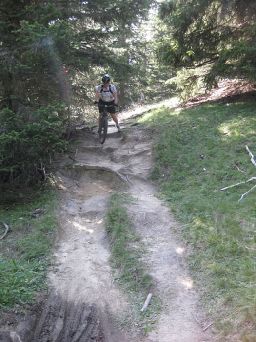
Technisch schwierig ist nur der Teil des Downhills der eini Stück über den "Madatschen Trail" führt, viele Wurzeln und Steine die öfter auch mal höhere Stufen bilden forden Konzentration bei der Abfahrt, wenn man nicht aufpasst legt man sich das eine oder andere mal ins Gras (wenn man Glück hat wie ich :-))
Daher sind wir dann wieder auf den Fahrweg ausgewichen um weitere Stürze aus dem Weg zu gehen.
Further information at
http://www.lifehotel-posthotel.com/posthotel/serfaus-hotel/mountainbike/mountainbike-touren.htmlTour gallery
Tour map and elevation profile
Minimum height 1365 m
Maximum height 2347 m
More about the tour author
|
|
dDesign |
Comments
Geigers Posthotel in Serfaus
GPS tracks
Trackpoints-
GPX / Garmin Map Source (gpx) download
-
TCX / Garmin Training Center® (tcx) download
-
CRS / Garmin Training Center® (crs) download
-
Google Earth (kml) download
-
G7ToWin (g7t) download
-
TTQV (trk) download
-
Overlay (ovl) download
-
Fugawi (txt) download
-
Kompass (DAV) Track (tk) download
-
Track data sheet (pdf) download
-
Original file of the author (gpx) download
More about the tour author
|
|
dDesign |
Add to my favorites
Remove from my favorites
Edit tags
Open track
My score
Rate
Tour am 4.10.10 gefahren