


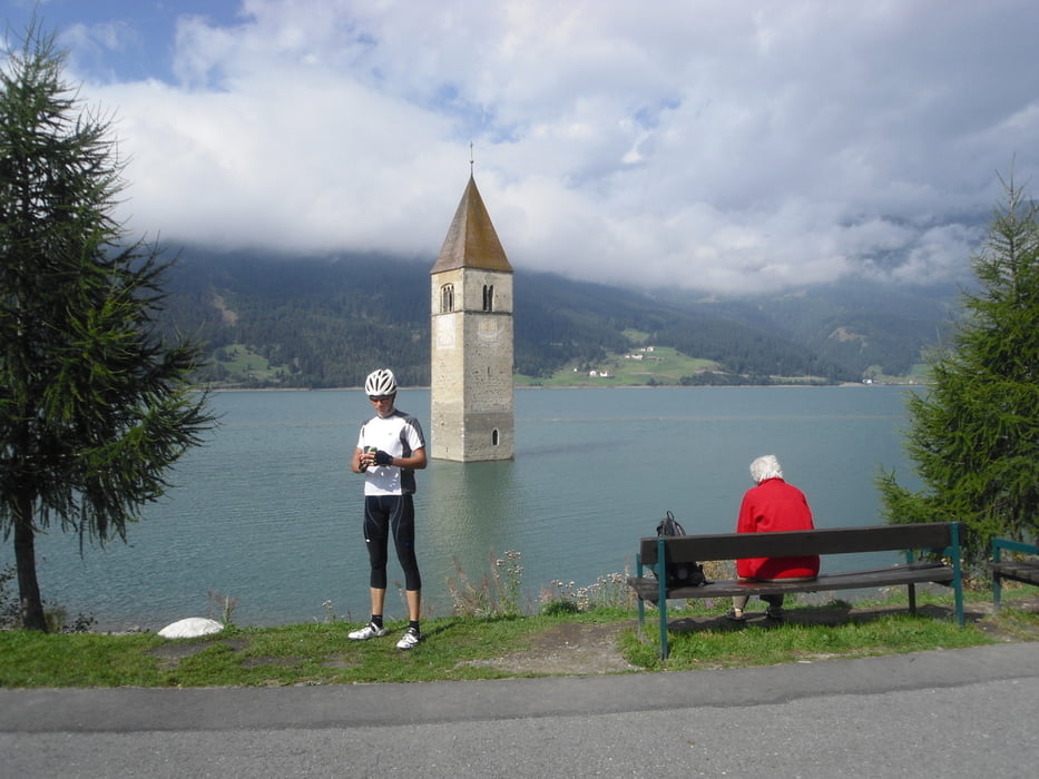
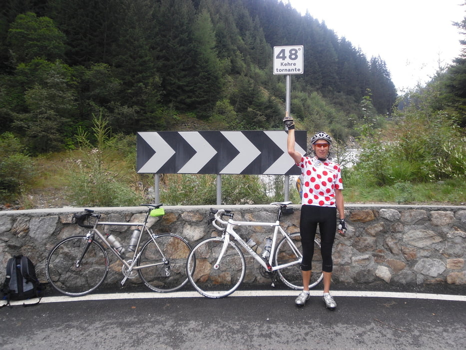
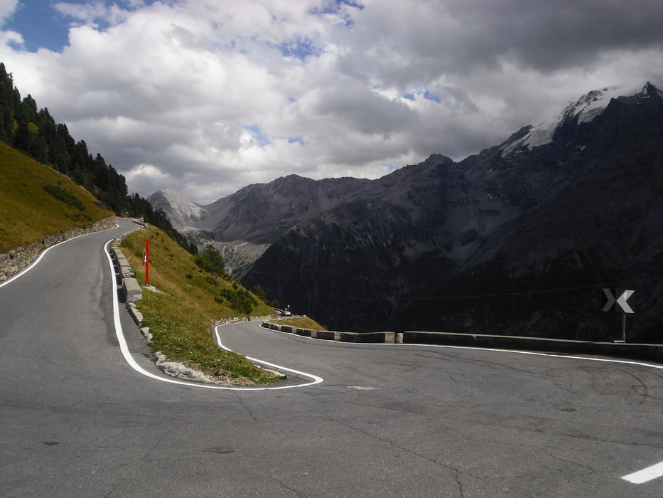
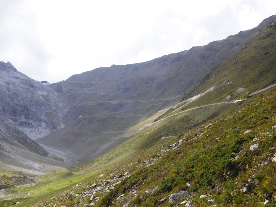
Heute stand der Reschenpass und das Stilfser Joch auf dem Programm, aus Landeck raus auf Nebenstraßen mussten wir ein paar Kilometer rauf auf die Bundesstraße bis Prutz. Dann wieder auf kleineren Straßen bis Pfunds, dort kann man rechts über die Schweiz weiter Richtung Reschenpass fahren, was wir aber nicht wußten uns so durch 1-2 Tunnel und viel Verkehr nach Nauders gelangten. Ab dort mit ordentlich Gegenwind ging es hoch über die Grenze zum Reschensee. Nach dem oblikatorischen Fotostop mit versunkener Kirche ging es in die Abfahrt nach Malles und weiter nach Prad. Dort ordentlich gestärkt ging es zum König der Pässe dem Passo dello Stelvio und den sollte man kennen, also nicht einfach reinknallen sondern schön die Kräfte einteilen. Nach einer Landschaftlich traumhaften Auffahrt ging es wieder schnell, sehr schnell runter nach Bormio und weiter zum Etappenziel Sant'Antonio.
Tour gallery
Tour map and elevation profile
Minimum height 795 m
Maximum height 2756 m
More about the tour author
|
|
titanbiker |
Comments

GPS tracks
Trackpoints-
GPX / Garmin Map Source (gpx) download
-
TCX / Garmin Training Center® (tcx) download
-
CRS / Garmin Training Center® (crs) download
-
Google Earth (kml) download
-
G7ToWin (g7t) download
-
TTQV (trk) download
-
Overlay (ovl) download
-
Fugawi (txt) download
-
Kompass (DAV) Track (tk) download
-
Track data sheet (pdf) download
-
Original file of the author (gpx) download
More about the tour author
|
|
titanbiker |
Add to my favorites
Remove from my favorites
Edit tags
Open track
My score
Rate