


Karte: BD8 Kebnekaise-Saltoluokta, Lantmäteriet
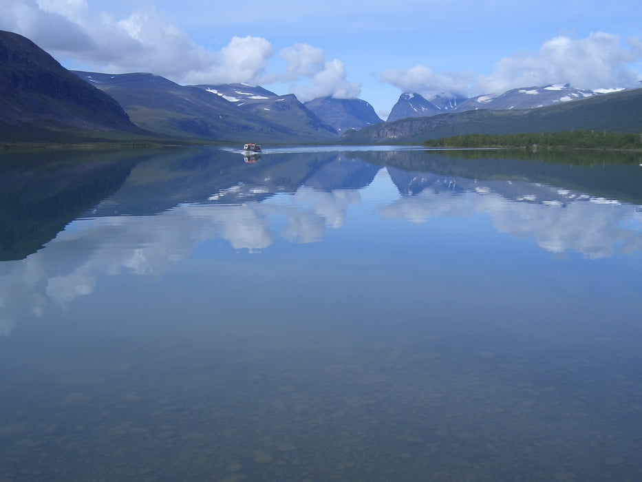
Ab Nikkaluokta auf dem ausgeschilderten Wanderweg bis zur Bootsanlegestelle am Laddjujavrisee. Hier mit dem Boot den See entlang und einige Kilometer den Fluß hinauf. Ab hier weiter dem Wanderweg durch die Birkenwälder bis zur Kebnekaise Fjällstation folgen.
Tour gallery


Tour map and elevation profile
Minimum height 426 m
Maximum height 670 m
More about the tour author

|
Carl P |
Comments

Mit dem Flugzeug (Air Berlin) nach Stockholm, dann weiter mit dem Flugzeug (SAS) nach Kiruna, geht auch mit dem (Nacht-)Zug. Von hier mit dem Bus nach Nikkaluokta.
GPS tracks
Trackpoints-
GPX / Garmin Map Source (gpx) download
-
TCX / Garmin Training Center® (tcx) download
-
CRS / Garmin Training Center® (crs) download
-
Google Earth (kml) download
-
G7ToWin (g7t) download
-
TTQV (trk) download
-
Overlay (ovl) download
-
Fugawi (txt) download
-
Kompass (DAV) Track (tk) download
-
Track data sheet (pdf) download
-
Original file of the author (gpx) download
More about the tour author
|
|
Carl P |
Add to my favorites
Remove from my favorites
Edit tags
Open track
My score
Rate