


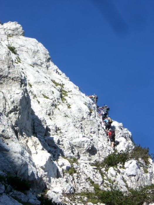
Lärchenturm (C/D) Koschutaüberschreitung ÖTK Steig (B/C) im Abstieg
Ausgangspunkt ist das Koschutahaus auf 1300 m.
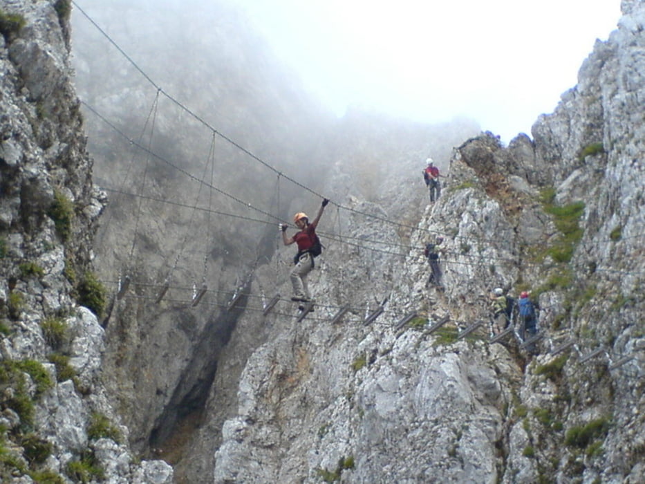
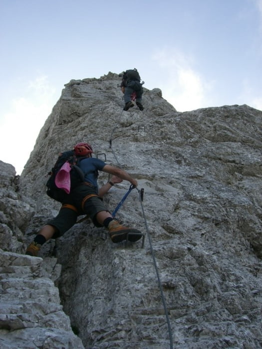
Sehr schöner und sicherer Klettersteig, der einige schwierige Stellen hat. Besonders der Abstieg vom Turm ist sehr schön. Dann folgt eine Überschreitung zum ÖTK Abstieg mit der neuen Brücke im Mittelteil.
Zeiten: Gehzeit- 5:40
Anstieg: 45 min. / Klettersteig Lärchenturm 2:00 Std / Überschreitung 1:20 / ÖTK Steig im Abstieg 30 min. / Rückweg zum Ausgangspunkt 40 min
Tour gallery
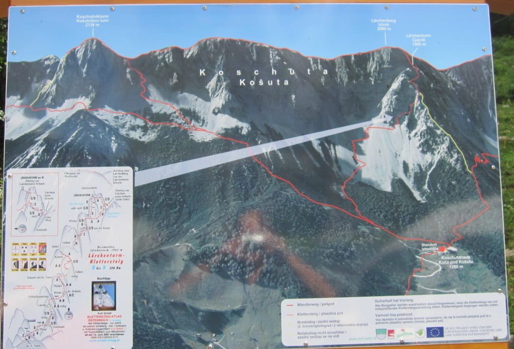
Tour map and elevation profile
Minimum height 1304 m
Maximum height 2135 m
More about the tour author
|
|
renrew |
Comments

Klagenfurt - Ferlach - Zell Pfarre - Straße zum Koschutahaus
GPS tracks
Trackpoints-
GPX / Garmin Map Source (gpx) download
-
TCX / Garmin Training Center® (tcx) download
-
CRS / Garmin Training Center® (crs) download
-
Google Earth (kml) download
-
G7ToWin (g7t) download
-
TTQV (trk) download
-
Overlay (ovl) download
-
Fugawi (txt) download
-
Kompass (DAV) Track (tk) download
-
Track data sheet (pdf) download
-
Original file of the author (gpx) download
More about the tour author
|
|
renrew |
Add to my favorites
Remove from my favorites
Edit tags
Open track
My score
Rate