


1. Etappe: Mittenwald - Weerberg, 98 Km, 1885 Hm
2. Etappe: Weerberg – Pfitscherjoch Haus , 64 Km, 3138 Hm
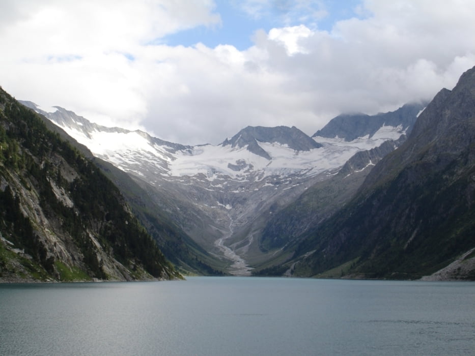
3. Etappe: Pfitscherjoch Haus – Schneeberg Haus, 62 Km, 1800 Hm
4. Etappe: Schneeberg Haus – St. Walburg, 80 Km, 1890 Hm
5. Etappe: St. Walburg – Andalo, 86 Km, 2372 Hm
6. Etappe: Andalo – Riva, 59 Km, 980 Hm
Die Hütten sollte man nach Möglichkeit vorreservieren.
www.pfitscherjochhaus.com
www.schneeberg.org
Zurück gings problemlos mit Bikeshuttle (info@bikeshuttle.it)
Tour gallery


Tour map and elevation profile
Minimum height 27 m
Maximum height 2685 m
More about the tour author
|
|
ralph.trapp |
Comments
Von München über die A95 Richtung Garmisch-Patenkirchen. In Garmisch links abbiegen Richtung Mittenwald. In Mittenwald gibt es einen Parkplatz auf dem die Tour startet. Das Auto kann man dort kostenfrei stehen lassen.
GPS tracks
Trackpoints-
GPX / Garmin Map Source (gpx) download
-
TCX / Garmin Training Center® (tcx) download
-
CRS / Garmin Training Center® (crs) download
-
Google Earth (kml) download
-
G7ToWin (g7t) download
-
TTQV (trk) download
-
Overlay (ovl) download
-
Fugawi (txt) download
-
Kompass (DAV) Track (tk) download
-
Track data sheet (pdf) download
-
Original file of the author (gpx) download
More about the tour author
|
|
ralph.trapp |
Add to my favorites
Remove from my favorites
Edit tags
Open track
My score
Rate
MTB Tansalp #43984
sind die Tour diesen Sommer abgefahren. Insgesamt sehr schöne Route!
Allerdings ist auf dem Weg zum Schneeberghaus das Schneebergjoch zu überwinden. D.h. auf einem steilen Wanderweg ca. 2 Std. MTB tragen (schieben nahezu unmöglich!) über Schneefelder...
Gruß Toni