Login

Forgot your login?

Cookies have to be accepted!
Your browser's cookie functionality is disabled. Please enable this functionality.

Not a member yet?

Register now
Login

Available for registred users only

Log in to use this feature.

Forgot your login?

Cookies have to be accepted!
Your browser's cookie functionality is disabled. Please enable this functionality.

Not a member yet?

Register now
Filter
Categories
Advanced filters
  • Distance (km)
  • Height
Save filters Reset filter

TrackRank

QRCode

Technical data

Distance50,9 km Height502 m Way down496 m Duration03:20 h:m Date17.07.2006
Scores Author User Landscape Fun factor Fitness Technique

Statistics

3075 Views 4 Scores 734 Downloads 4.25 Average
Rate
  • Track data sheet
  • Directions
  • Downloads
Schöne abwechslungsreiche Tour durch diverse Täler (Glastal, großes Lautertal, Wolfstal, Donautal) und die Höhen der zwiefalter Alb.

Tour gallery

Tour map and elevation profile

  • Open Street Map
  • Google
Minimum height 517 m Maximum height 730 m Detailed view

More about the tour author

gpsstevek
Member since 2006

Send private message

Comments

GunnarTUE on 15.08.2009

Sehr schöne Tour!

Vielen Dank für's Einstellen dieser Tour. Ich habe sie am letzten Sonntagnachmittag genossen und fand die Täler wirklich beeindruckend. Das Wetter war prima und es hat alles gepasst. Nach dem beschriebenen 3,5h war ich dann auch herrlich schlapp - aber glücklich.
Thoschu on 22.04.2011

Hat Spass gemacht

Wirklich ne sehr, sehr schöne Tour! Sehr abwechslungsreich vom Gelände und von der Landschaft sowieso ein Traum. Vielen Dank fürs Einstellen. Kann ich nur jedem empfehlen, der es mal etwas gemütlicher angehen will und trotzdem den totalen Ausgleich vom Alltag sucht!
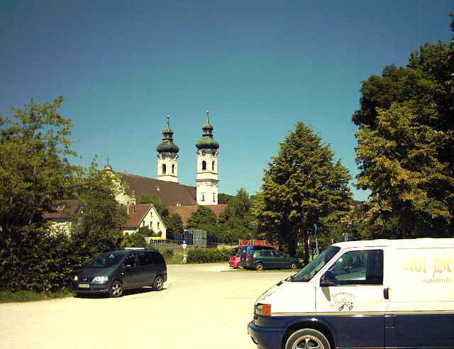
zwiefalten liegt an der B312 zwischen reutlingen und Riedlingen.
Großer kostenfreier Parkplatz beim Sportplat.(In ortsmitte zwischen Brauerei und Kloster ins Dobeltal abbiegen, dann gleich rechts.

GPS tracks

Trackpoints
  • GPX / Garmin Map Source (gpx) download
  • TCX / Garmin Training Center® (tcx) download
  • CRS / Garmin Training Center® (crs) download
  • Google Earth (kml) download
  • G7ToWin (g7t) download
  • TTQV (trk) download
  • Overlay (ovl) download
  • Fugawi (txt) download
  • Kompass (DAV) Track (tk) download
  • Track data sheet (pdf) download
  • Original file of the author (gpx) download

More about the tour author

gpsstevek
Member since 2006

Send private message
Share track
Add to my favorites
Remove from my favorites
Edit tags
My score
Rate
Track: Zwiefalter Alb und Tälertour
Type: Mountain bike
Distance: 50,9 km
Evaluated on:
Duration:
Day(s)
Hour(s)
Minute(s)
Score: Landscape Fun factor Fitness Technique