
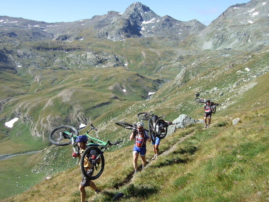

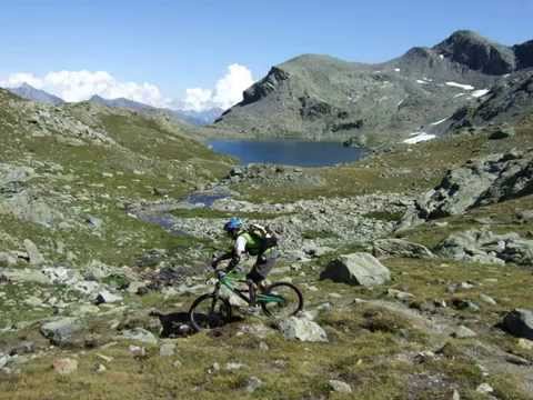
Questo è un itinerario dove le salite si fanno quasi tutte con la mtb in spalla e la discesa tecnica e a volte senza sentiero.
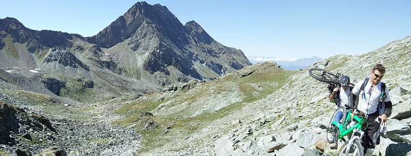
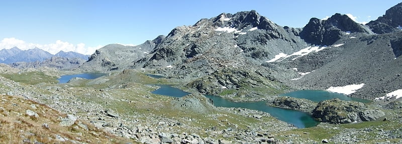
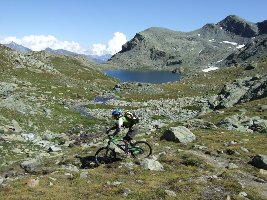
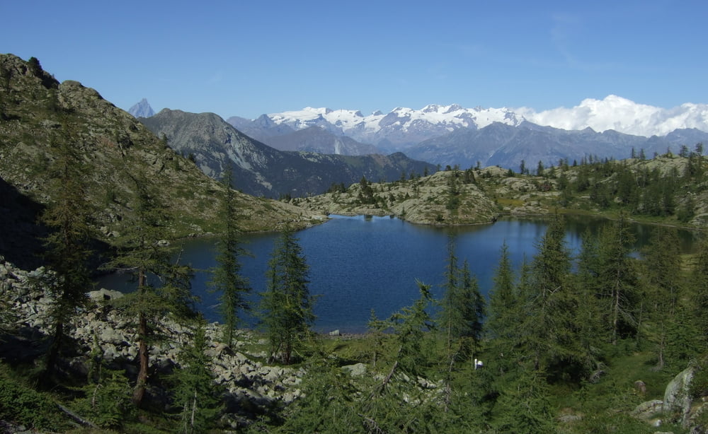
Partenza in Valle d’Aosta nella Valle di Champorcher, a Petit Montblanc quota 1750, dove finisce l’asfalto. Salita per la strada sterrata fino a quota 2350m dove si attraversa il torrente su un ponte un po piegato. Adesso si segue il sentiero che porta alla forcella Col Fussi 2910m, prima discesa tenendo sempre il sentiero a dx per arrivare alla Col dell’Eyelè 2785m, discesa super tecnica fino il lago Margheron 2370m, adesso si risale sul sentiero poco evidente (ma intuitivo) fino raggiungere il Colle Mezove 2617m, da qui vista fantastica sui laghi tra qui il Gran Lago 2500m . Discesa sempre molto tecnica ma bellissima fino il Lago Bianco 2170m, adesso mancano soli 150m di mtb in spalla fino al colle del Lago Bianco per scendere poi sul bellissimo sentiero fino alla macchina.
Tour gallery


Tour map and elevation profile
Minimum height 1768 m
Maximum height 2911 m
More about the tour author

|
Silvia_Arno |
Comments

GPS tracks
Trackpoints-
GPX / Garmin Map Source (gpx) download
-
TCX / Garmin Training Center® (tcx) download
-
CRS / Garmin Training Center® (crs) download
-
Google Earth (kml) download
-
G7ToWin (g7t) download
-
TTQV (trk) download
-
Overlay (ovl) download
-
Fugawi (txt) download
-
Kompass (DAV) Track (tk) download
-
Track data sheet (pdf) download
-
Original file of the author (gpx) download
More about the tour author
|
|
Silvia_Arno |
Add to my favorites
Remove from my favorites
Edit tags
Open track
My score
Rate