


Sarnonico-Fondo-Penegal-Mendolapass
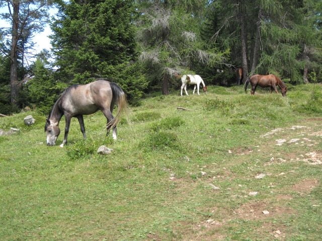
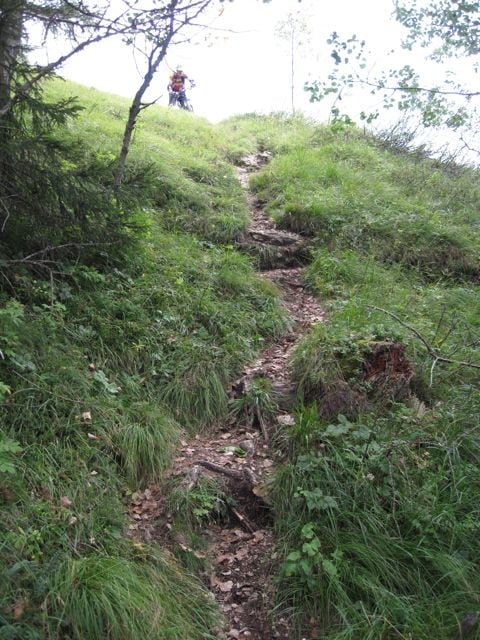
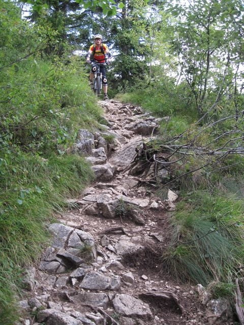
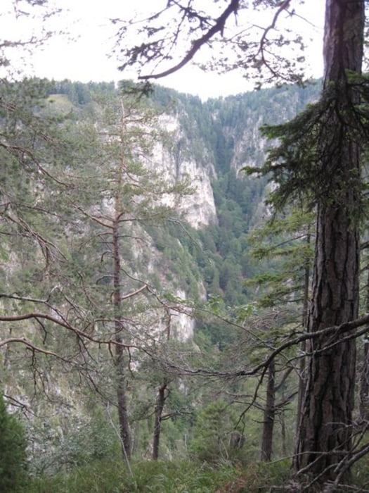
DieTour startet in Sarnonico (Campingplatz) Richtung Fondo (sehenswerter Ort), dann hoch zum Gipfel Penegal. Dieser Aufstieg geht erst auf einer Asphaltstraße, dann ab einem Naturschutzpark auf einem Schotterweg Richtung Penegal. Später wird der Weg zum Trail, dieser ist aber fahrbar (gute Konditionvorausgesetzt). Am Penegal angekommen hat man eine Traum Aussicht auf das Bozener Tal. Vom Penegal geht es auf einen Wandersteig/Pfard Richtung Medolapass. Ab hier beginnt einen Supertrail. Achtung!!! An manchen Stellen ausgesetzt und nur mit guter Fahrtechnik zu empfehlen (siehe Bilder). Am Medolapass angekommen gehts wieder runter nach Cavareno, leider haben wir den Einstieg in einen Trail verpasst und sind auf der Asphaltstraße bis Ruffré Mendola abgefahren. Dann gings aber weiter auf einen schönen Weg ins Tal und zurück nach Sarnonico. Viel Spaß!!!
Tour gallery
Tour map and elevation profile
Minimum height 976 m
Maximum height 1722 m
More about the tour author
|
|
tontassi |
Comments

GPS tracks
Trackpoints-
GPX / Garmin Map Source (gpx) download
-
TCX / Garmin Training Center® (tcx) download
-
CRS / Garmin Training Center® (crs) download
-
Google Earth (kml) download
-
G7ToWin (g7t) download
-
TTQV (trk) download
-
Overlay (ovl) download
-
Fugawi (txt) download
-
Kompass (DAV) Track (tk) download
-
Track data sheet (pdf) download
-
Original file of the author (gpx) download
More about the tour author
|
|
tontassi |
Add to my favorites
Remove from my favorites
Edit tags
Open track
My score
Rate