


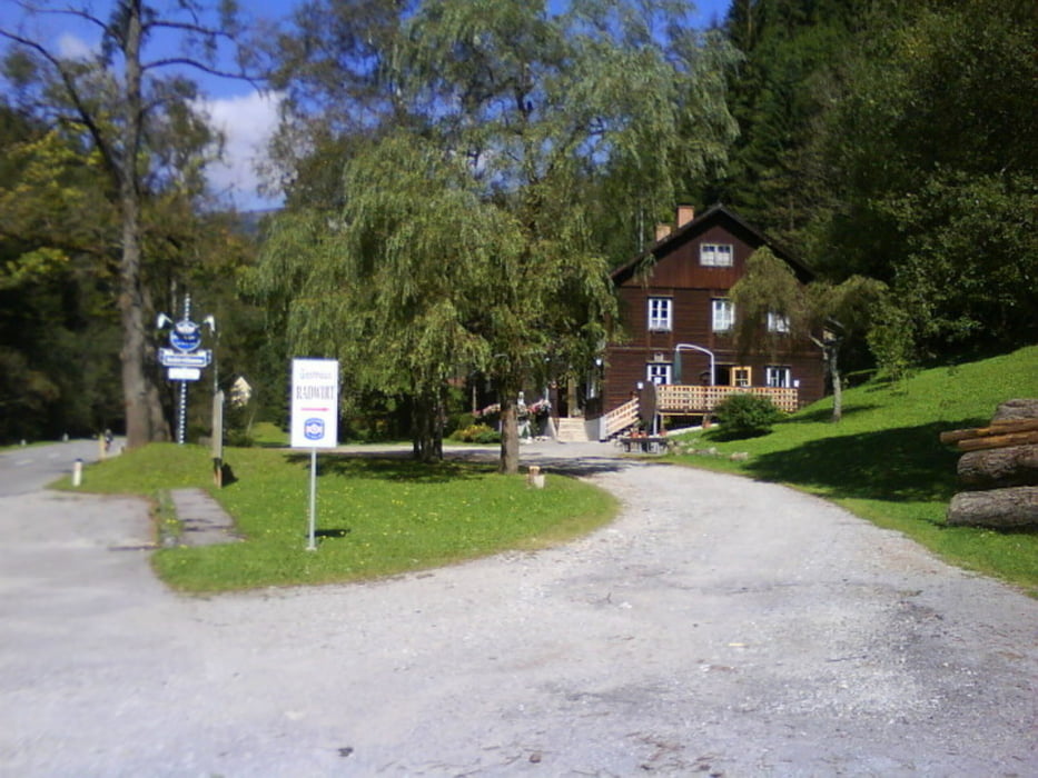
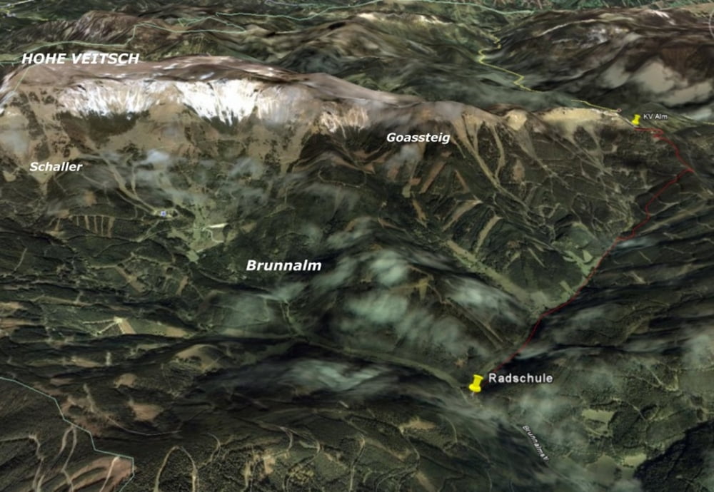
Gemütliche Wanderung von der Radschule (830 M) auf die Kleinveitschalm (1430m).
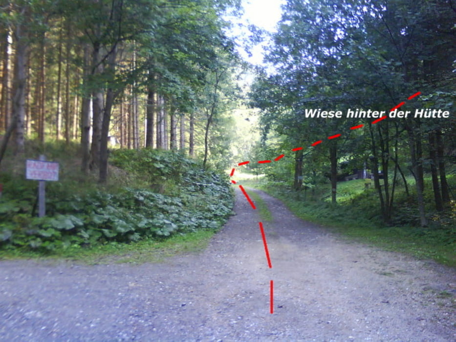
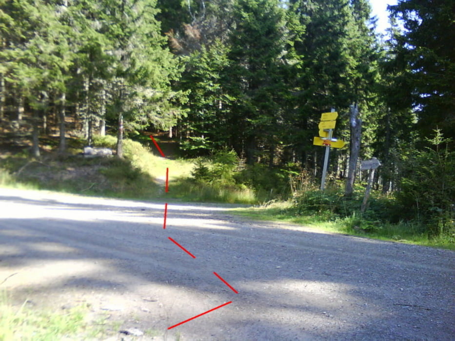
Von der Radschule der Forststraße in den Steinbachgraben ca. 2,2,km folgen (bis hierher könnte man auch mit dem PKW fahren) bis man zu einer Weggabelung mit 2 Schranken kommt. Dort befindet sich auf der rechten Seite eine kleine Hütte. Hier geradeaus bis nach 150 m der Wanderweg rechts einer Wiese folgend hinaufgeht. Am Ende der Wiese führt der weitere Weg leicht steigend, über 4 Forststraßen querend, hinauf bis zum Anhangtor. Dann in nördl. Richtung dem Wanderweg folgen, bis man auf eine Forststraße kommt. Dieser entlang und nach 100m links den Wanderweg weiter folgen bis man letztendlich auf die Kleinveitsch Alm kommt.
Kleinveitschalm: Grundbauerhütte im Sommer an den Wochenenden bewirtschaftet
Ausgangspunkt: Radschule ( in der Nähe GH Radwirt)
Further information at
http://www.veitsch.at/cms/media/Wanderungen/5WanderungenKV/5WanderungenKV.htmlTour gallery
Tour map and elevation profile
Minimum height 761 m
Maximum height 1424 m
More about the tour author
|
|
renrew |
Comments

Austbahnabfahrt S6 bei Mitterdorf im Mürztal Richtung Veitsch. Über Dorf Veitsch - Grpoß Veitsch Richtung Brunnalm bis zum Radwirt oder der ehem. Radschule.
GPS tracks
Trackpoints-
GPX / Garmin Map Source (gpx) download
-
TCX / Garmin Training Center® (tcx) download
-
CRS / Garmin Training Center® (crs) download
-
Google Earth (kml) download
-
G7ToWin (g7t) download
-
TTQV (trk) download
-
Overlay (ovl) download
-
Fugawi (txt) download
-
Kompass (DAV) Track (tk) download
-
Track data sheet (pdf) download
-
Original file of the author (gpx) download
More about the tour author
|
|
renrew |
Add to my favorites
Remove from my favorites
Edit tags
Open track
My score
Rate