


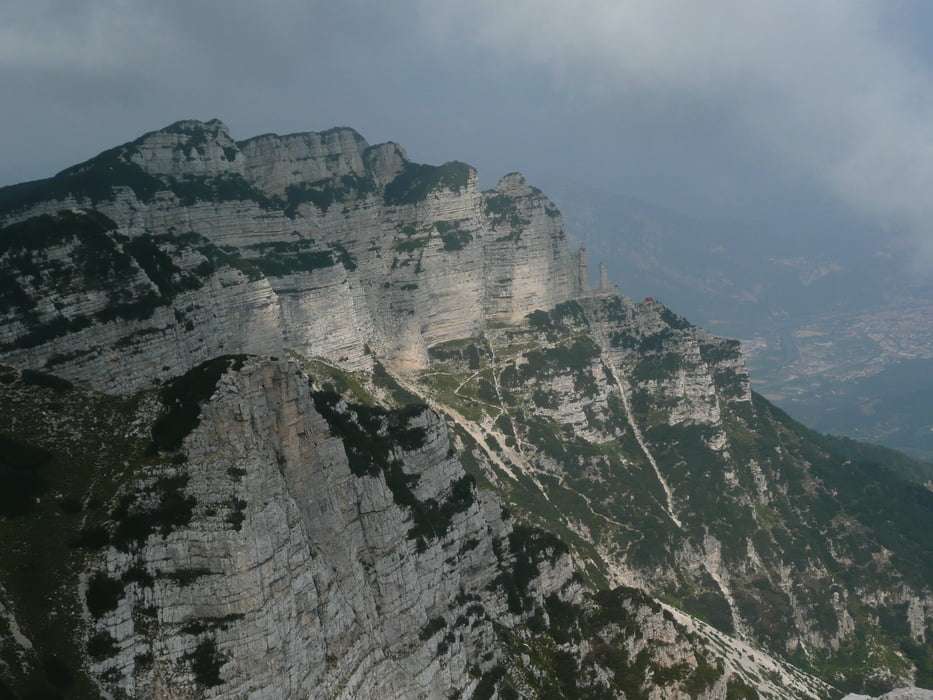
Wanderung auf den Becco di Filadonna.
Beginnend an der Fahrstraße SS 349 ging es zuerst den Fahrweg hoch zum Rifugio Casarota, da der Wanderweg 442 im unteren Bereich gesperrt war. Bis zum Gipfel benötigten wir (2 Erw. 2 Ki.) 1 Stunde 50 Minuten reine Gehzeit. Über die Wanderwege 425 und 439 ging es wieder zur SS 349 zurück. Die angegebene Zeit ist incl. Pausen.
Besser wäre es die Wanderung in umgekehrter Form zu laufen, da man dann die Einkehrmöglichkeit im Rifugio nutzen kann.
Tour gallery

Tour map and elevation profile
Minimum height 1097 m
Maximum height 2144 m
More about the tour author

|
Comments

Aud der SS 349 befinden sich immer wieder genügend Möglichkeiten das Auto abzustellen.
GPS tracks
Trackpoints-
GPX / Garmin Map Source (gpx) download
-
TCX / Garmin Training Center® (tcx) download
-
CRS / Garmin Training Center® (crs) download
-
Google Earth (kml) download
-
G7ToWin (g7t) download
-
TTQV (trk) download
-
Overlay (ovl) download
-
Fugawi (txt) download
-
Kompass (DAV) Track (tk) download
-
Track data sheet (pdf) download
-
Original file of the author (gpx) download
More about the tour author
|
|
Add to my favorites
Remove from my favorites
Edit tags
Open track
My score
Rate