


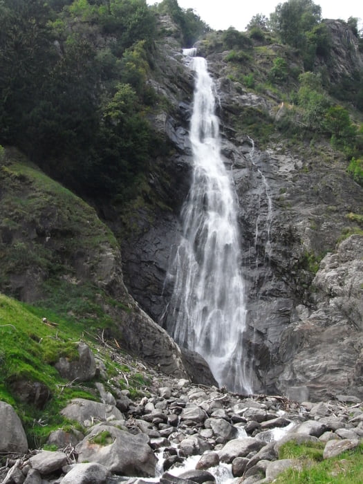
die Tour war als kleine Nachmittagstour geplant. Wurde aber auf Grund der Höhenmeter doch ganz schön anstrengend.
Die Jause im Durster hat sich dafür aber rentiert. => Tipp! Der Durster hat eine eigene Himbeerplantage.
Varianten: Wenn man die Tour am Parkplatz Birkenwald beginnt kann man sich 300 Höhemneter sparen.
(Habe die Daten aktualisiert: Die Tour beginnt am Parkplatz Bireknwald. man kann aber auch in Patschings starten und am Ende vom Durster direkt nach Patschings runter)
Tour gallery
Tour map and elevation profile
Minimum height 953 m
Maximum height 1343 m
More about the tour author
|
|
Massimiliano |
Comments

GPS tracks
Trackpoints-
GPX / Garmin Map Source (gpx) download
-
TCX / Garmin Training Center® (tcx) download
-
CRS / Garmin Training Center® (crs) download
-
Google Earth (kml) download
-
G7ToWin (g7t) download
-
TTQV (trk) download
-
Overlay (ovl) download
-
Fugawi (txt) download
-
Kompass (DAV) Track (tk) download
-
Track data sheet (pdf) download
-
Original file of the author (gpx) download
More about the tour author
|
|
Massimiliano |
Add to my favorites
Remove from my favorites
Edit tags
Open track
My score
Rate