Login

Forgotten password?

Cookies have to be accepted!
Your browser's cookie functionality is disabled. Please enable this functionality.

Not a member yet?

Register now
Login

Available for registred users only

Log in to use this feature.

Forgotten password?

Cookies have to be accepted!
Your browser's cookie functionality is disabled. Please enable this functionality.

Not a member yet?

Register now
Filter
Categories
Advanced filters
  • Distance (km)
  • Height
Save filters Reset filter

TrackRank

QRCode

Technical data

Distance1,6 km Height54 m Way down269 m Duration01:00 h:m Date17.09.2009
Scores Author Landscape Fun factor Fitness Technique

Statistics

2118 Views Scores 40 Downloads Average
Rate
  • Track data sheet
  • Directions
  • Downloads
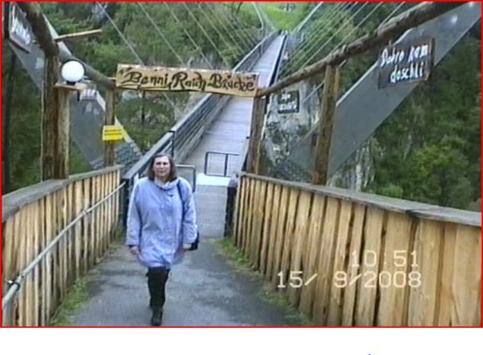
Vom Parkplatz neben dem Schulhaus der Ortschaft Wald der Markierung zur Benni Raich Brücke folgen.

Further information at

http://www.pitztal.com/kultur-tirol/benni-raich-bruecke0.html

Tour gallery

Tour map and elevation profile

  • Open Street Map
  • Google
Minimum height 811 m Maximum height 1099 m Detailed view

More about the tour author

KaufensH
Member since 2004

Send private message

Comments

Von Imst im Inntal zur Ortschaft Arzl am Anfang des Pitztales und weiter zum Ortsteil Wald.

GPS tracks

Trackpoints
  • GPX / Garmin Map Source (gpx) download
  • TCX / Garmin Training Center® (tcx) download
  • CRS / Garmin Training Center® (crs) download
  • Google Earth (kml) download
  • G7ToWin (g7t) download
  • TTQV (trk) download
  • Overlay (ovl) download
  • Fugawi (txt) download
  • Kompass (DAV) Track (tk) download
  • Track data sheet (pdf) download
  • Original file of the author (gpx) download

More about the tour author

KaufensH
Member since 2004

Send private message
Share track
Add to my favorites
Remove from my favorites
Edit tags
My score
Rate
Track: WAld i. Pitztal - Benni Raich Brücke (Pitzenklammbrücke)
Type: Hiking
Distance: 1,6 km
Evaluated on:
Duration:
Day(s)
Hour(s)
Minute(s)
Score: Landscape Fun factor Fitness Technique