Login

Forgot your login?

Cookies have to be accepted!
Your browser's cookie functionality is disabled. Please enable this functionality.

Not a member yet?

Register now
Login

Available for registred users only

Log in to use this feature.

Forgot your login?

Cookies have to be accepted!
Your browser's cookie functionality is disabled. Please enable this functionality.

Not a member yet?

Register now
Filter
Categories
Advanced filters
  • Distance (km)
  • Height
Save filters Reset filter

TrackRank

QRCode

Technical data

Distance34,1 km Height509 m Way down514 m Duration01:45 h:m Date19.09.2009
Scores Author Landscape Fun factor Fitness Technique

Statistics

367 Views Scores 68 Downloads Average
Rate
  • Track data sheet
  • Directions
  • Downloads
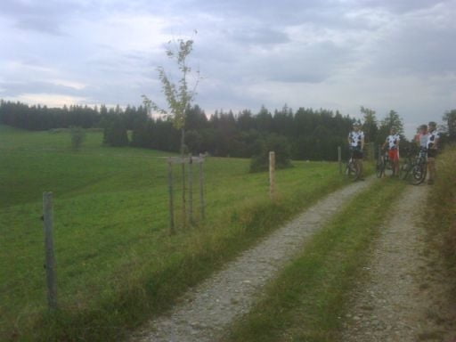
Herbsttour, die geprägt ist durch frühe Dunkelheit und kürzere Fahreiten - von Ratzenried über Eisenharz in den Osterwald, an der Badwirtschaft Malleichen vorbei nach Schmalenberg, von dort nach Eglofstal - Aschen und auf schönen Forst- und Nebenwegen zurück

Tour map and elevation profile

  • Open Street Map
  • Google
Minimum height 572 m Maximum height 724 m Detailed view

More about the tour author

Rasch
Member since 2008

Send private message

Comments

GPS tracks

Trackpoints
  • GPX / Garmin Map Source (gpx) download
  • TCX / Garmin Training Center® (tcx) download
  • CRS / Garmin Training Center® (crs) download
  • Google Earth (kml) download
  • G7ToWin (g7t) download
  • TTQV (trk) download
  • Overlay (ovl) download
  • Fugawi (txt) download
  • Kompass (DAV) Track (tk) download
  • Track data sheet (pdf) download
  • Original file of the author (gpx) download

More about the tour author

Rasch
Member since 2008

Send private message
Share track
Add to my favorites
Remove from my favorites
Edit tags
My score
Rate
Track: Montagstour 10 Bike-Team Ratzenried
Type: Mountain bike
Distance: 34,1 km
Evaluated on:
Duration:
Day(s)
Hour(s)
Minute(s)
Score: Landscape Fun factor Fitness Technique