


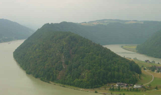
Nach der bayrischen Dreiflüssestadt fliesst die Donau, von dicht bewaldeten Hängen begleitet, durch das enge Tal zwischen dem Bayrischen Wald und dem Sauwald geradlienig bis Schlögen. Hier zwingt der harte Granit den Fluss zu einer derart engen Schleife, dass die Donau quasi zurückfliesst. Nach dem grossartigen Naturschauspiel in der Schlögener Schlinge tritt die Donau bei Aschach in das fruchtbare Eferdinger Becken ein.
Tour gallery
Tour map and elevation profile
Minimum height 264 m
Maximum height 383 m
More about the tour author

|
Comments

Bahn: bis Passau Hbf.
Auto: A3 aus Deutschland, A8 aus Österreich bis Passau Mitte
Auto: A3 aus Deutschland, A8 aus Österreich bis Passau Mitte
GPS tracks
Trackpoints-
GPX / Garmin Map Source (gpx) download
-
TCX / Garmin Training Center® (tcx) download
-
CRS / Garmin Training Center® (crs) download
-
Google Earth (kml) download
-
G7ToWin (g7t) download
-
TTQV (trk) download
-
Overlay (ovl) download
-
Fugawi (txt) download
-
Kompass (DAV) Track (tk) download
-
Track data sheet (pdf) download
-
Original file of the author (g7t) download
More about the tour author
|
|
Add to my favorites
Remove from my favorites
Edit tags
Open track
My score
Rate