


Marokko - ein Land, welches nur wenige Flugstunden von Österreich entfernt ist - dennoch landet man in einer anderen Welt: 4000m hohe Berge, endlose Wüsten, brodelnde Souks in alten Stadtvierteln, mittelalterliche Berbersiedlungen ...
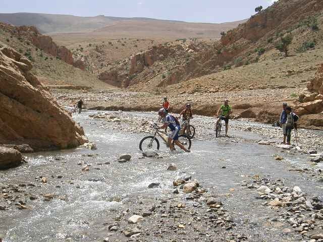
Mit insgesamt 573km - aufgeteilt auf 9 Etappen - überqueren wir den Hohen Atlas durch traumhafte Schluchten, heiße Steinwüsten, grüne Oasen, einsame Berberdörfer, vorbei an unzähligen Straßenhändlern, bettelnden Kindern und durchs Land ziehende Nomaden.
Mit insgesamt 573km - aufgeteilt auf 9 Etappen - überqueren wir den Hohen Atlas durch traumhafte Schluchten, heiße Steinwüsten, grüne Oasen, einsame Berberdörfer, vorbei an unzähligen Straßenhändlern, bettelnden Kindern und durchs Land ziehende Nomaden.
Further information at
http://www.bike-4-fun.at/marokko_2006.htmTour gallery
Tour map and elevation profile
Minimum height 817 m
Maximum height 2912 m
More about the tour author
|
|
franz.resch |
Comments

Anreise mit Fugzeug über Frankfurt nach Casablanca. Transfer mit Auto nach Marrakech und weiter auf den Tizi-n-Tichka Pass. Von hier startet die eigentliche Tour.
GPS tracks
Trackpoints-
GPX / Garmin Map Source (gpx) download
-
TCX / Garmin Training Center® (tcx) download
-
CRS / Garmin Training Center® (crs) download
-
Google Earth (kml) download
-
G7ToWin (g7t) download
-
TTQV (trk) download
-
Overlay (ovl) download
-
Fugawi (txt) download
-
Kompass (DAV) Track (tk) download
-
Track data sheet (pdf) download
-
Original file of the author (g7t) download
More about the tour author
|
|
franz.resch |
Add to my favorites
Remove from my favorites
Edit tags
Open track
My score
Rate