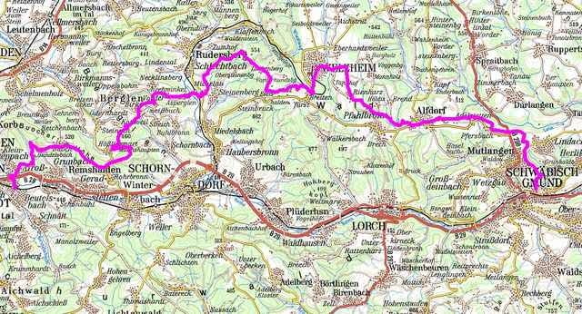
Entspannte und gut befahrene Radwege vorwiegend auf Asphalt. Befahren werden Routen wie Limes, Wieslauftal und Rems-Murr Radwanderweg.
Bei Welzheim kommt man auch an einem Badesee vorbei.
Eignet sich sehr gut für eine Ganztagestour mit einer sportlichen Familie. Die Strecke ist technisch nicht anspruchsvoll, dafür fordert sie einen von der sportlichen Seite, da es immer auf und ab geht. Eine typische Strecke für Treckingbikes. Natürlich auch mit dem MTB befahrbar, aber für empfindliche Rennreder nicht zu empfehlen
Further information at
http://danke-sagen.deTour gallery
Tour map and elevation profile
Minimum height 231 m
Maximum height 551 m
Comments

Gegenüber vom Eingang des Freibades in Schwäbisch Gmünd fährt ein Waldweg hoch direkt auf den Track.
Ankunft ist das Feuerwehrhaus in Beutelsbach auf de r Poststrasse nicht weit vom Beutelsbacher Bahnhof entfernt
Ankunft ist das Feuerwehrhaus in Beutelsbach auf de r Poststrasse nicht weit vom Beutelsbacher Bahnhof entfernt
GPS tracks
Trackpoints-
GPX / Garmin Map Source (gpx) download
-
TCX / Garmin Training Center® (tcx) download
-
CRS / Garmin Training Center® (crs) download
-
Google Earth (kml) download
-
G7ToWin (g7t) download
-
TTQV (trk) download
-
Overlay (ovl) download
-
Fugawi (txt) download
-
Kompass (DAV) Track (tk) download
-
Track data sheet (pdf) download
-
Original file of the author (g7t) download
Add to my favorites
Remove from my favorites
Edit tags
Open track
My score
Rate


