


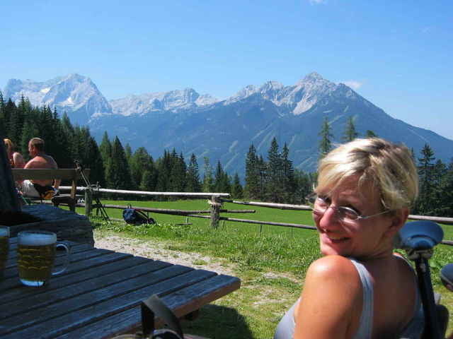
Gestartet wird vom Parkplatz Hinterstoder. Über schöne zum Teil knackige Anstiege geht es über Vorderstoder zur Steyrsbergerreith. Dort unbedingt eine längere Pause einplanen die Aussicht auf den großen Priel ist einfach grandios. Erstaunlich dass es heute noch so eine urige bewirtschaftet Hütte gibt. Von der netten Hüttenwirtin haben wir erfahren dass die Hütte seit 300 Jahren in Familienbesitz ist. Mindestens so alt ist das Häuschen schon.
Die Abfahrt ist ebenfalls ein Highlight dieser Runde. Fast jeder hm wird im Trail nach unten bewältigt. Kleine Supertour
Die Abfahrt ist ebenfalls ein Highlight dieser Runde. Fast jeder hm wird im Trail nach unten bewältigt. Kleine Supertour
Tour gallery
Tour map and elevation profile
Minimum height 592 m
Maximum height 1182 m
More about the tour author
|
|
ingo |
Comments

Von der A1 über die A9 zur Ausfahrt Hinterstoder. Den Schildern nach Hinterstoder folgen. Der große Parkplatz befindet sich am Beginn des Ortes. Die Runde führt im Uhrzeigersinn.
GPS tracks
Trackpoints-
GPX / Garmin Map Source (gpx) download
-
TCX / Garmin Training Center® (tcx) download
-
CRS / Garmin Training Center® (crs) download
-
Google Earth (kml) download
-
G7ToWin (g7t) download
-
TTQV (trk) download
-
Overlay (ovl) download
-
Fugawi (txt) download
-
Kompass (DAV) Track (tk) download
-
Track data sheet (pdf) download
-
Original file of the author (g7t) download
More about the tour author
|
|
ingo |
Add to my favorites
Remove from my favorites
Edit tags
Open track
My score
Rate