Login

Forgot your login?

Cookies have to be accepted!
Your browser's cookie functionality is disabled. Please enable this functionality.

Not a member yet?

Register now
Login

Available for registred users only

Log in to use this feature.

Forgot your login?

Cookies have to be accepted!
Your browser's cookie functionality is disabled. Please enable this functionality.

Not a member yet?

Register now
Filter
Categories
Advanced filters
  • Distance (km)
  • Height
Save filters Reset filter

TrackRank

QRCode

Technical data

Distance33,6 km Height471 m Way down466 m Duration02:20 h:m Date05.10.2009
Scores Author Landscape Fun factor Fitness Technique

Statistics

782 Views 2 Scores 154 Downloads 3.50 Average
Rate
  • Track data sheet
  • Directions
  • Downloads

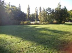
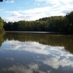
Tour an die Seen um Sindelfingen:

- Klostersee

- Katzenbachsee

- Neuer See

- Bärensee

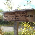
Zwischen dem Klostersee und dem Katzenbachsee noch kurzen Abstecher zur höchsten Erhebung Stuttgarts: die Bernhardtshöhe


Versorgungsmöglichkeiten:
Cafe Wiesn in Sindelfingen (beim Klostersee)
Katzenbacher Hof
Bärenschlössle


Tour gallery

Tour map and elevation profile

  • Open Street Map
  • Google
Minimum height 411 m Maximum height 541 m Detailed view

More about the tour author

Hatschi
Member since 2009

Send private message

Comments

Start in Sindelfingen für die Seentour an der BACHSTRASSE

Parkmöglichkeit am Floschenstadion

GPS tracks

Trackpoints
  • GPX / Garmin Map Source (gpx) download
  • TCX / Garmin Training Center® (tcx) download
  • CRS / Garmin Training Center® (crs) download
  • Google Earth (kml) download
  • G7ToWin (g7t) download
  • TTQV (trk) download
  • Overlay (ovl) download
  • Fugawi (txt) download
  • Kompass (DAV) Track (tk) download
  • Track data sheet (pdf) download
  • Original file of the author (gpx) download

More about the tour author

Hatschi
Member since 2009

Send private message
Share track
Add to my favorites
Remove from my favorites
Edit tags
My score
Rate
Track: Sindelfinger Seentour
Type: Mountain bike
Distance: 33,6 km
Evaluated on:
Duration:
Day(s)
Hour(s)
Minute(s)
Score: Landscape Fun factor Fitness Technique