


Der Rundkurs startet in Spittal/Drau und führt über die in der Regel nur sehr schwach befahrende Katschberg Bundesstraße das Liesertal hinauf. Tipp: Vorher erkundigen, ob Tauernautobahn frei ist. Dort wird momentan gebaut. Wenn gesperrt oder umgeleitet wird, ist auf der Bundesstraße die Hölle los. Wenn nicht: alles bestens.
Anschließend geht es rechts weg Richtung Innerkrems und der wunderschönen Nockalmstraße, die direkt durch den Nationalpark Nockberge führt. Die Rückfahrt führt über Patergassen und Bad Kleinkirchheim entlang des Millstätter Sees bis zurück nach Spittal.
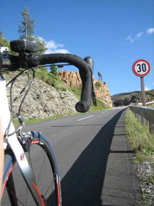
Die Asphalt-Qualität ist durchwegs gut bis sehr gut. Verpfegungsstationen und Brunnen gibt es reichlich (als Waypoints im File beigefügt). Sehenswert sind auch die zweigeteilte Kirche "Kreuzbichl" (Straße führt mitten durch) bei Gmünd und der historische Hochhofen bei Eisentratten. In der Region wurde früher Eisen abgebaut.
Eine der schönsten Touren, die ich kenne!
Anschließend geht es rechts weg Richtung Innerkrems und der wunderschönen Nockalmstraße, die direkt durch den Nationalpark Nockberge führt. Die Rückfahrt führt über Patergassen und Bad Kleinkirchheim entlang des Millstätter Sees bis zurück nach Spittal.
Die Asphalt-Qualität ist durchwegs gut bis sehr gut. Verpfegungsstationen und Brunnen gibt es reichlich (als Waypoints im File beigefügt). Sehenswert sind auch die zweigeteilte Kirche "Kreuzbichl" (Straße führt mitten durch) bei Gmünd und der historische Hochhofen bei Eisentratten. In der Region wurde früher Eisen abgebaut.
Eine der schönsten Touren, die ich kenne!
Further information at
http://www.nockalmstrasse.at/Tour gallery
Tour map and elevation profile
Minimum height 573 m
Maximum height 2039 m
More about the tour author
|
|
texx |
Comments

Direkt über A2 Südautobahn oder A10 Tauernautobahn erreichbar.
GPS tracks
Trackpoints-
GPX / Garmin Map Source (gpx) download
-
TCX / Garmin Training Center® (tcx) download
-
CRS / Garmin Training Center® (crs) download
-
Google Earth (kml) download
-
G7ToWin (g7t) download
-
TTQV (trk) download
-
Overlay (ovl) download
-
Fugawi (txt) download
-
Kompass (DAV) Track (tk) download
-
Track data sheet (pdf) download
-
Original file of the author (gpx) download
More about the tour author
|
|
texx |
Add to my favorites
Remove from my favorites
Edit tags
Open track
My score
Rate