


Sehr abwechslungsreiche Tour von Bergedorf über Lauenburg nach Echem.
Anfangs, etwa bis Geesthacht, verhältnmismäßig hoher Straßenanteil. Kurz vor Geesthacxht habe ich den Weg verloren und musste mich durchs Unterholz schlagen. Diese Stelle ist per Wegpunkt markiert, evtl. ausweichen.
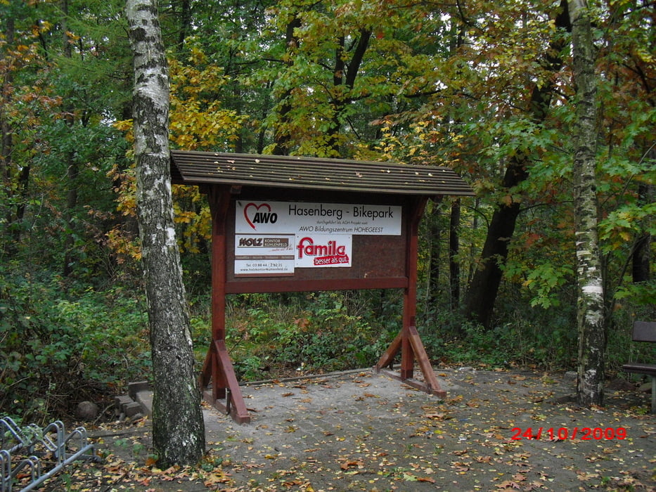
In Lauenburg gibt es einen kleinen Abstecher auf den dortigen Bikepark (Hasenberg). Sehr nette Anlage.
Stichworte: Bergedorf, Elbe, Geesthacht, Krümmel, Lauenburg, Echem, Erthenenburg, Bikepark,
Further information at
http://www.bahn.de/p/view/index.shtmlTour gallery


Tour map and elevation profile
Minimum height -39 m
Maximum height 103 m
More about the tour author
|
|
Folki |
Comments

Start: S-Bahn Bergedorf
Ziel: Echem Bahnhof
Alternativen: Weiter nach Lüneburg (ca 20km)
Lauenburg (dann etwa 10km weniger)
Ab Lauenburg weiter nach Büchen
GPS tracks
Trackpoints-
GPX / Garmin Map Source (gpx) download
-
TCX / Garmin Training Center® (tcx) download
-
CRS / Garmin Training Center® (crs) download
-
Google Earth (kml) download
-
G7ToWin (g7t) download
-
TTQV (trk) download
-
Overlay (ovl) download
-
Fugawi (txt) download
-
Kompass (DAV) Track (tk) download
-
Track data sheet (pdf) download
-
Original file of the author (gpx) download
More about the tour author
|
|
Folki |
Add to my favorites
Remove from my favorites
Edit tags
Open track
My score
Rate