


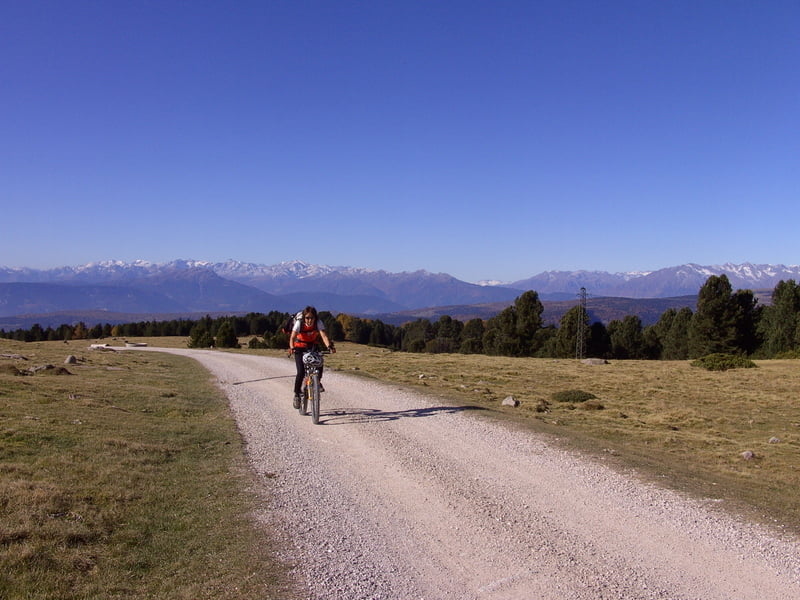
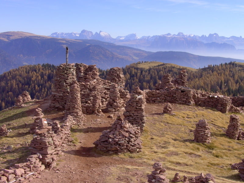
landschaftlich sehr schöne Rundtour im Bozener Raum. Nach dem Start in Bozen geht es sehr steil hoch nach Oberbozen(Gem. Ritten), dann weiter zum Rittner Horn. Hier hat man eine grandiose Rundumsicht. Weiter nach Norden auf riesigen Hochflächen und schönen Wegen nach Reinswald in das Durnholzer Tal. Wo sonst Kühe weiden hier die Pferde, vorwiegend Haflinger. Vom Durnholzer Tal gelang man in`s Sarntal und bei Sarntheim wieder hoch über das Auener Joch. Für den kurzen Abstecher zu den Stoanernen Mandln sollte auf jedenfall Zeit genommen werden. Nun über das Voraner Joch, Hafling, Mölten nach Bozen hinunter zum Ausgangpunkt. Da die Tage Ende Okt./Anf.Nov. schon sehr kurz waren, fuhren wir die Tour in 3 Tagen.
Tour gallery


Tour map and elevation profile
Minimum height 276 m
Maximum height 2268 m
More about the tour author
|
|
yr1willi |
Comments

Parkplatz an der Seilbahn Kohlern.
GPS tracks
Trackpoints-
GPX / Garmin Map Source (gpx) download
-
TCX / Garmin Training Center® (tcx) download
-
CRS / Garmin Training Center® (crs) download
-
Google Earth (kml) download
-
G7ToWin (g7t) download
-
TTQV (trk) download
-
Overlay (ovl) download
-
Fugawi (txt) download
-
Kompass (DAV) Track (tk) download
-
Track data sheet (pdf) download
-
Original file of the author (gpx) download
More about the tour author
|
|
yr1willi |
Add to my favorites
Remove from my favorites
Edit tags
Open track
My score
Rate