

Genusstour in jeder Hinsicht. Schöne Landschaft, einfacher Trail und der Uphill per Seilbahn möglich. Familienfreundliche MTB-Runde über den Bergen Merans. Schöne, meist einfache Trails.
Startpunkt ist die Seilbahnstation in Lana. Biketransport ist dort problemlos und zu halbwegs vernünftigen Preisen möglich (Achtung: bei hohem Andrang KEIN Biketransport zwischen 10 und 13 Uhr). Am Ausstieg beim architektonisch auffällige Mountain Ressort Hotel über den Wanderweg 33, später 31 (Eggersteig nach St. Martin). Fast die gesamte Strecke verläuft abwärts. Am Ende der Abfahrt ist noch eine kurze S1 Trailstrecke eingebaut. Im Tal geht es bequem und flott auf Teer zurück nach Lana.
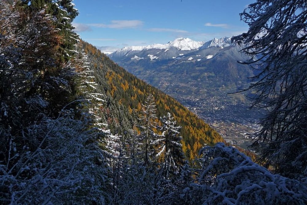
Im Herbst sensationelle Färbung der Lärchenwälder.
Further information at
http://www.vigilio.com/Tour map and elevation profile
Minimum height 278 m
Maximum height 1500 m
More about the tour author
|
|
freizeit-as |
Comments

Nach Lana zur Seilbahnstation. Dort sind auch Parkmöglichkeiten. In der Saison ist die Vigilbahn sehr gut besucht. Bei der Zeitplanung sollte man das berücksichtigen.
GPS tracks
Trackpoints-
GPX / Garmin Map Source (gpx) download
-
TCX / Garmin Training Center® (tcx) download
-
CRS / Garmin Training Center® (crs) download
-
Google Earth (kml) download
-
G7ToWin (g7t) download
-
TTQV (trk) download
-
Overlay (ovl) download
-
Fugawi (txt) download
-
Kompass (DAV) Track (tk) download
-
Track data sheet (pdf) download
-
Original file of the author (gpx) download
More about the tour author
|
|
freizeit-as |
Add to my favorites
Remove from my favorites
Edit tags
Open track
My score
Rate