


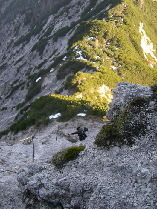
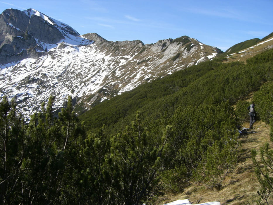
Von Gosau am Passgschütt der Forststraße vorbei am Iglmoos 1206 m zur Wiesalm. Von dort nach Markierten Wanderweg Richtung Neualm und nach ca 2 KM der roten Punktmarkierung folgen bis zur Kreuzung Wilder Jäger Knall Alm. Ansteigen zum Brettkogel 1585 m und auf ausgesetztem Steig zum Wilden Jäger 1842 m. Von dort in langer Hangquerung bis unter dem Gipfel des Gamsfeldes und in steilem Anstieg über Almboden zum Gamsfeld Gipfel 2027 m. Abstieg auf markiertem Wanderweg zur Traunwandalm und von dieser zum Parkplatz des bereitgestellten Autos in Rußbach.
Further information at
http://www.gosaunet.at/tipps/sommer/wandern/gamsfeld.htmlTour gallery


Tour map and elevation profile
Minimum height 811 m
Maximum height 2036 m
More about the tour author
|
|
kaiser630 |
Comments

Bad Ischl- Bad Goisern -Gosau im Salzkammergut - zur Passgschütt Höhe. Dort Parkmöglichkeit.
Zweites Auto in Rußbach bereitstellen.
GPS tracks
Trackpoints-
GPX / Garmin Map Source (gpx) download
-
TCX / Garmin Training Center® (tcx) download
-
CRS / Garmin Training Center® (crs) download
-
Google Earth (kml) download
-
G7ToWin (g7t) download
-
TTQV (trk) download
-
Overlay (ovl) download
-
Fugawi (txt) download
-
Kompass (DAV) Track (tk) download
-
Track data sheet (pdf) download
-
Original file of the author (gpx) download
More about the tour author
|
|
kaiser630 |
Add to my favorites
Remove from my favorites
Edit tags
Open track
My score
Rate