


Pilgerweg vom Brombachsee nach Donauwörth (Weißenburg-Pappenheim)
Variation (kein offizieller Jakobsweg), vielmehr mein Versuch eine Verbindung vom Fränkischen Jakobsweg (Nürnberg nach Ulm) auf die Jakobswege von Eichstätt kommend in Donauwörth zu schaffen.
Von Weißenburg geht es auf der Holzgasse hoch zur "Jakobsruhe" (einen Aussichtspunkt) und durch den Ludwigswald nach Haardt.
Weitere Higlights:
- Gunthildisbrunnen und Gunthildiskapelle
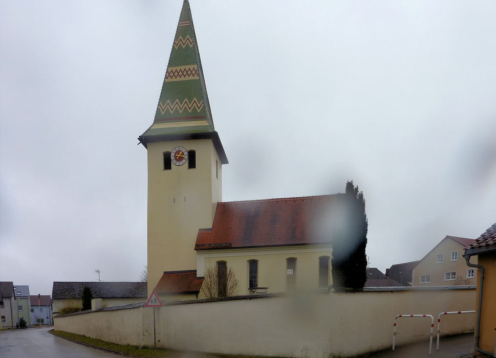
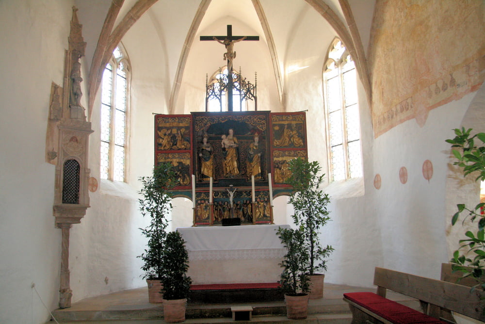
- St. Jakobskirche in Neudorf
- Naturdenkmäler
- Steinbrunnen nach Neudorf
- Pappenheim (St. Gallus und alle anderen Kirchen)
- 001 - Geiselberg - Ramsberg (Hafen, wenn der Trimaran fährt, äh schwimmt)
- 001a - Absberg (Hafen, wenn kein Schiffsverkehr) - Ramsberg (Fußweg rechts um den Brombachsee)
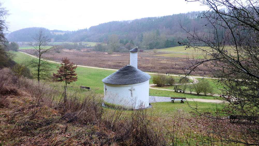
- 001b - Absberg (Hafen, wenn kein Schiffsverkehr) - Ramsberg (Fußweg links um den See über Enderndorf, Ottmannsberg zum ehemaligen Kloster (nur noch Kapelle) Heiligenblut nach Allmannsdorf und über den Hauptdamm nach Ramsberg)
- 002 - Ramsberg - Weißenburg i. Bay.
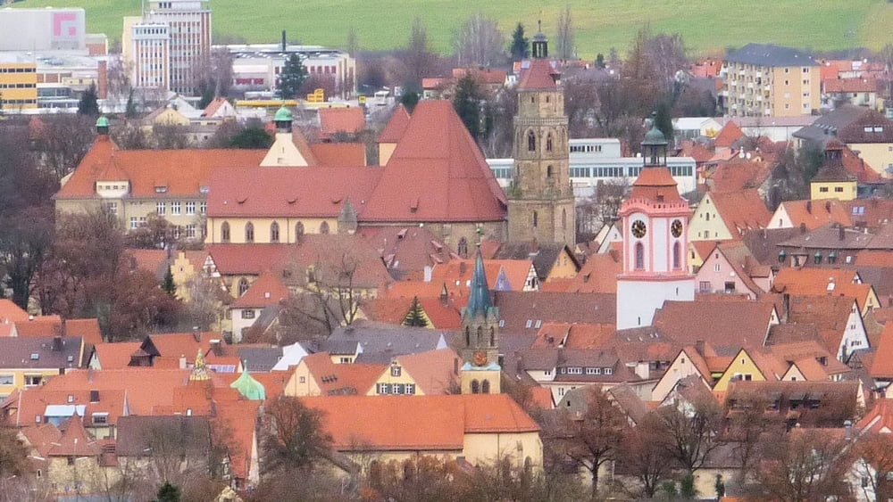
- 003 - Weißenburg i. Bay. - Pappenheim
- 004 - Pappenheim - Tagmersheim
- 005 - Tagmersheim - Marxheim-Bruck
Der Jakobsweg von Nürnberg nach Ulm
- Nürnberg - Schwabach
- Schwabach - Geiselberg
- Geiselberg - Gunzenhausen (Gelaufen aber von Georgensgmünd über Spalt nach Geiselberg und ab hier dann auf dem Jakobsweg weiter nach Gunzenhausen)
- Gunzenhausen - Hohentrüdingen
- Hohentrüdingen - Wallerstein
- Wallerstein - Neresheim
- Neresheim - Hürben (In Hürben gibt es auch das Jakobswegele)
- Hürben - Nerenstetten
- Nerenstetten - Ulm
Dann geht es weiter auf dem Jakobsweg von Ulm nach Konstanz
- Ulm - Oberdischingen
- die weiteren Etappen siehe bitte ab hier
Viel Spass beim Entdecken
- Stadt Weißenburg
- Stadt Pappenheim
- Burg Pappenheim
- Neudorf und die Grafendörfer
- St. Jakob in Neudorf
- St. Gunthildis
- St. Jakobsaltar in der St. Andreaskirche in Weißenburg
Further information at
http://www.naturpark-altmuehltal.de/Tour gallery
Tour map and elevation profile
Minimum height 407 m
Maximum height 613 m
More about the tour author
|
|
Rezatfisch |
Comments

GPS tracks
Trackpoints-
GPX / Garmin Map Source (gpx) download
-
TCX / Garmin Training Center® (tcx) download
-
CRS / Garmin Training Center® (crs) download
-
Google Earth (kml) download
-
G7ToWin (g7t) download
-
TTQV (trk) download
-
Overlay (ovl) download
-
Fugawi (txt) download
-
Kompass (DAV) Track (tk) download
-
Track data sheet (pdf) download
-
Original file of the author (gpx) download
More about the tour author
|
|
Rezatfisch |
Add to my favorites
Remove from my favorites
Edit tags
Open track
My score
Rate