Login

Forgot your login?

Cookies have to be accepted!
Your browser's cookie functionality is disabled. Please enable this functionality.

Not a member yet?

Register now
Login

Available for registred users only

Log in to use this feature.

Forgot your login?

Cookies have to be accepted!
Your browser's cookie functionality is disabled. Please enable this functionality.

Not a member yet?

Register now
Filter
Categories
Advanced filters
  • Distance (km)
  • Height
Save filters Reset filter

TrackRank

QRCode

Technical data

Distance33,5 km Height1040 m Way down1038 m Duration00:00 h:m Date10.01.2010
Scores Author User Landscape Fun factor Fitness Technique

Statistics

832 Views 1 Score 298 Downloads 4.00 Average
Rate
  • Track data sheet
  • Directions
  • Downloads

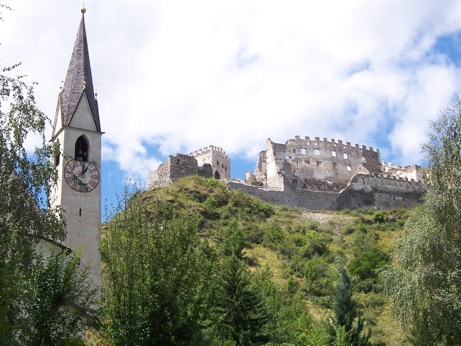
Start ist in Taufers. Zuerst geht es bergab am Rambach entlang, danach auf einem schönen Waldweg zur Burgruine Lichtenberg. Der Rückweg führt über Glurns und danach am Anfahrtsweg zurück nach Taufers.

Tour gallery

Tour map and elevation profile

  • Open Street Map
  • Google
Minimum height 898 m Maximum height 1470 m Detailed view

More about the tour author

ARUP
Member since 2009

Send private message

Comments

GPS tracks

Trackpoints
  • GPX / Garmin Map Source (gpx) download
  • TCX / Garmin Training Center® (tcx) download
  • CRS / Garmin Training Center® (crs) download
  • Google Earth (kml) download
  • G7ToWin (g7t) download
  • TTQV (trk) download
  • Overlay (ovl) download
  • Fugawi (txt) download
  • Kompass (DAV) Track (tk) download
  • Track data sheet (pdf) download
  • Original file of the author (gpx) download

More about the tour author

ARUP
Member since 2009

Send private message
Share track
Add to my favorites
Remove from my favorites
Edit tags
My score
Rate
Track: Burgruine Lichtenberg Tour
Type: Mountain bike
Distance: 33,5 km
Evaluated on:
Duration:
Day(s)
Hour(s)
Minute(s)
Score: Landscape Fun factor Fitness Technique