Login

Forgot your login?

Cookies have to be accepted!
Your browser's cookie functionality is disabled. Please enable this functionality.

Not a member yet?

Register now
Login

Available for registred users only

Log in to use this feature.

Forgot your login?

Cookies have to be accepted!
Your browser's cookie functionality is disabled. Please enable this functionality.

Not a member yet?

Register now
Filter
Categories
Advanced filters
  • Distance (km)
  • Height
Save filters Reset filter

TrackRank

QRCode

Technical data

Distance18,2 km Height524 m Way down171 m Duration04:30 h:m Date27.02.2010
Scores Author Landscape Fun factor Fitness Technique

Statistics

949 Views Scores 16 Downloads Average
Rate
  • Track data sheet
  • Directions
  • Downloads

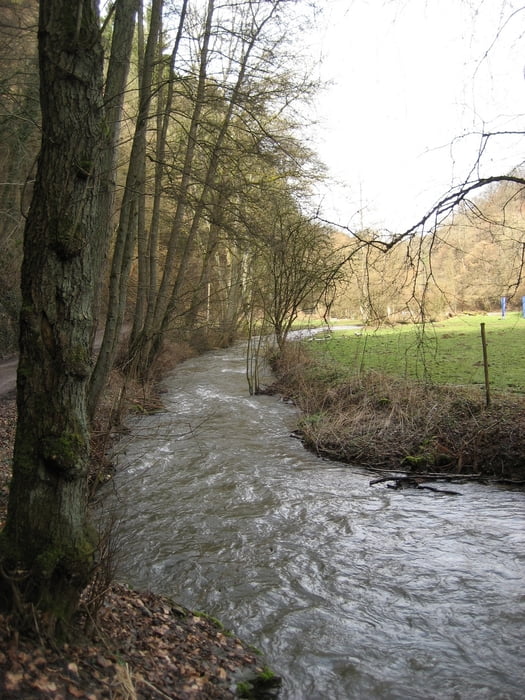
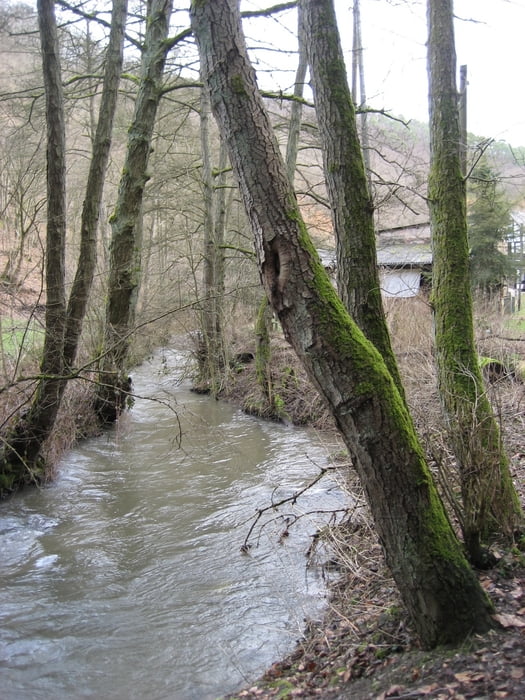
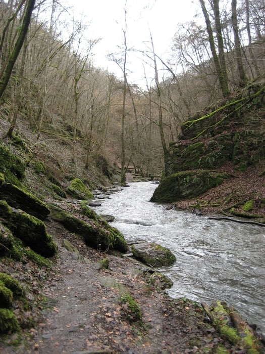
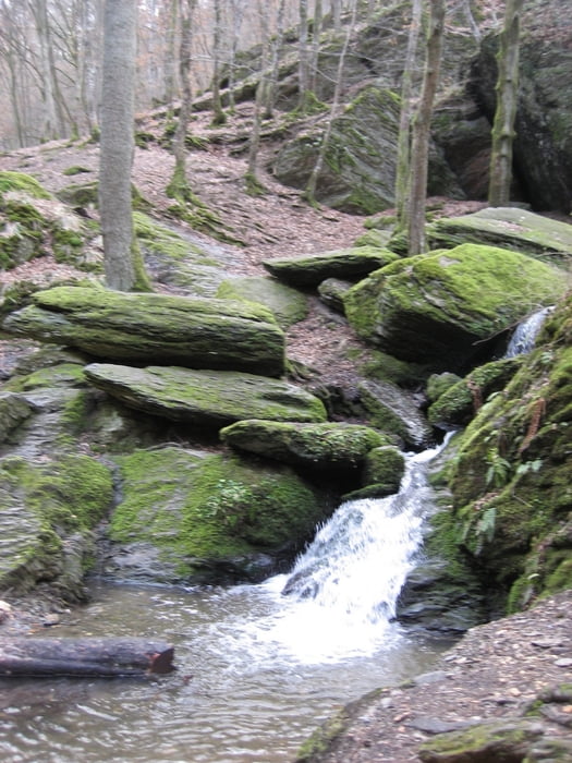
Die Tour beginnt in Brodenbach an der Mosel und es geht teilweise recht steil hoch. Gute Kondition sollte man mitbringen. Ein kleiner Abstecher zur Ehrenburg und die Ehrbachklamm sind auch dabei. Die Tour endet am Hotel Zur Katz in Halsenbach-Ehr.

Tour gallery

Tour map and elevation profile

  • Open Street Map
  • Google
Minimum height 88 m Maximum height 450 m Detailed view

More about the tour author

Damian
Member since 2009

Send private message

Comments

GPS tracks

Trackpoints
  • GPX / Garmin Map Source (gpx) download
  • TCX / Garmin Training Center® (tcx) download
  • CRS / Garmin Training Center® (crs) download
  • Google Earth (kml) download
  • G7ToWin (g7t) download
  • TTQV (trk) download
  • Overlay (ovl) download
  • Fugawi (txt) download
  • Kompass (DAV) Track (tk) download
  • Track data sheet (pdf) download
  • Original file of the author (gpx) download

More about the tour author

Damian
Member since 2009

Send private message
Share track
Add to my favorites
Remove from my favorites
Edit tags
My score
Rate
Track: Von Brodenbach über die Ehrbachklamm nach Halsenbach
Type: Hiking
Distance: 18,2 km
Evaluated on:
Duration:
Day(s)
Hour(s)
Minute(s)
Score: Landscape Fun factor Fitness Technique