


Hochdahl bis Wülfrath
Dies ist die erste Frühlingsrunde 2010, sie beginnt bei bestem Wetter (fast 20 Grad) in Hochdahl.
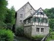
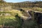
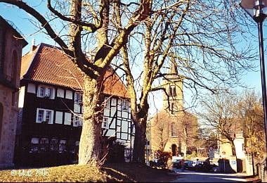
Der größte Teil verläuft über Wander-, Feld-, und Wirtschaftswege und ist auch bei feuchtem Wetter noch gut zu fahren. Von Hochdahl aus geht es in das Düsseltal hinein, durch den alten Dorfkern von Gruiten und in den alten Steinbruch (Grube 7). Von dort aus weiter richtung Schöller, Düssel und Wülfrath. Ab Wülfrath beginnt die Rückrunde über die Felder in richtung Mettmann und wieder in das Düsseltal zurück.
Viel Spaß beim Nachfahren !
Tour gallery
Tour map and elevation profile
Minimum height 73 m
Maximum height 224 m
More about the tour author
|
|
MarcusVergin |
Comments

GPS tracks
Trackpoints-
GPX / Garmin Map Source (gpx) download
-
TCX / Garmin Training Center® (tcx) download
-
CRS / Garmin Training Center® (crs) download
-
Google Earth (kml) download
-
G7ToWin (g7t) download
-
TTQV (trk) download
-
Overlay (ovl) download
-
Fugawi (txt) download
-
Kompass (DAV) Track (tk) download
-
Track data sheet (pdf) download
-
Original file of the author (gpx) download
More about the tour author
|
|
MarcusVergin |
Add to my favorites
Remove from my favorites
Edit tags
Open track
My score
Rate