


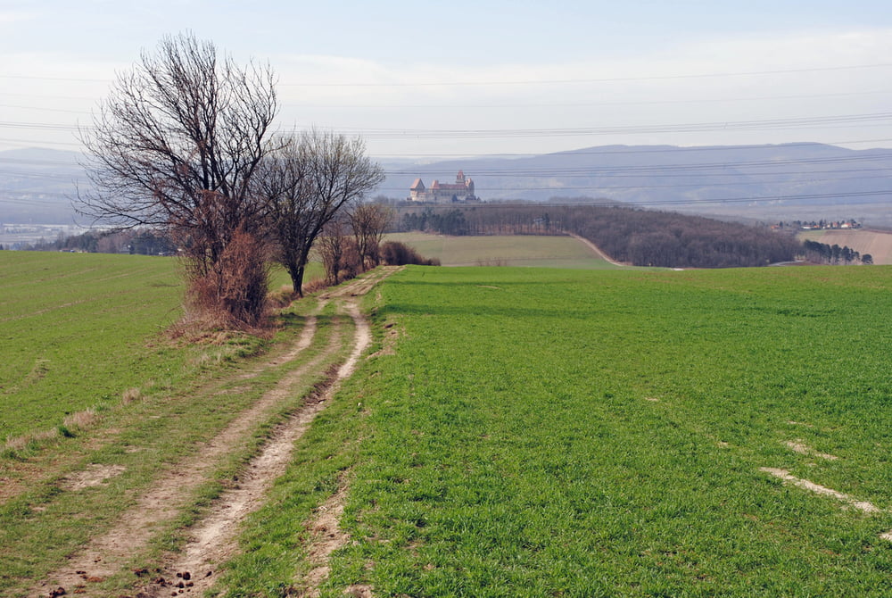
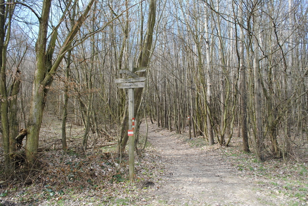
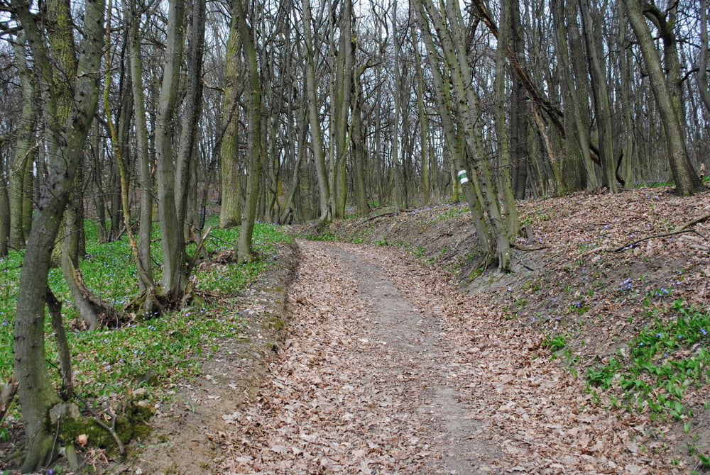
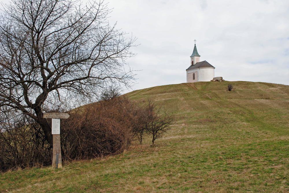
Auto am Parkplatz Burg Kreuzenstein abstellen.Gleich bei der Parkplatzeinfahrt links Waldpfad mit roter Markierung begehen.Nun bergauf und bergab(teilweise Forststrassen querend, bis zu einen Pferdegestüt..Dieses wird rechts umgangen,ebenso der Toblerberg.Abstieg immer noch auf roter Markierung bis zum Gasthaus "Goldenes Bründl".Schaut vielversprechend aus ,hatte aber leider Ruhetag(Montag und Dienstag).Nunmehr auf grüner Markierung den Wiesenbach folgend,später etwas ansteigend bis zu einer Wegkreuzung.Dort rechts hinauf ,an einer Jausenstation vorbei,die nur am Wochenende offen hat.Die letzten Höhenmeter und dann stehen wir vor der sehr beeindruckenden Michelkapelle.Rast und herrlicher Rundblick.Abstieg wie Aufstieg weil wir ja zu unseren Auto müssen.Schade,es gäbe noch viele Varianten von dort oben!!!
Tour gallery
Tour map and elevation profile
Minimum height 220 m
Maximum height 419 m
More about the tour author
|
|
LeoCheops |
Comments

GPS tracks
Trackpoints-
GPX / Garmin Map Source (gpx) download
-
TCX / Garmin Training Center® (tcx) download
-
CRS / Garmin Training Center® (crs) download
-
Google Earth (kml) download
-
G7ToWin (g7t) download
-
TTQV (trk) download
-
Overlay (ovl) download
-
Fugawi (txt) download
-
Kompass (DAV) Track (tk) download
-
Track data sheet (pdf) download
-
Original file of the author (gpx) download
More about the tour author
|
|
LeoCheops |
Add to my favorites
Remove from my favorites
Edit tags
Open track
My score
Rate