


Langkofel-Runde
Tourverlauf : Campitello-Canazei-Sella Joch-Rif.Comici-Saltria-Pas Duron-Campitello
Wie Herz und Seele aus Stein stehen Langkofel und Plattkofel zwischen den ladinischen Tälern Val di Fassa und Val Gardena (Grödner Tal).
Wir starten die Tour in Campitello,folgen dem Weg am Bach entlang immer Richtung Cannazei, von Cannazei auf der Asphaltstraße zum Sella Joch, unterhalb vom Sella Joch Haus , abbiegen auf den Schotterweg durch die Steinerne Stadt, mit absolutem Traumblick zum Sellastock, Piz Pordoi, Langkofel, Marmolada. Gigantischer Trail an der Lagkofelostwand entlang.
Es empfielt sich im Rif. Comici eine Rast einzulegen, anschließend 10 min Tragestrecke Bergab, weiter in Richtung Saltria (Seiser Alm), über sanfte Almwege immer Bergan, erst sanft ansteigend dann zum Seieseralmhaus 2143m , dann immer Steiler( gut fahrbar). Von dort aus toller Rundumblick auf die Schlerngruppe und Seiser Alm
Von dort aus weiter zum Passo Duron.
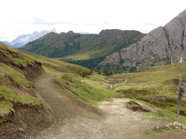
Gigantischer Schotterdownhill durchs Val Duron zum Ausgangspunkt Campitello im Val di Vassa.
Tourverlauf : Campitello-Canazei-Sella Joch-Rif.Comici-Saltria-Pas Duron-Campitello
Wie Herz und Seele aus Stein stehen Langkofel und Plattkofel zwischen den ladinischen Tälern Val di Fassa und Val Gardena (Grödner Tal).
Wir starten die Tour in Campitello,folgen dem Weg am Bach entlang immer Richtung Cannazei, von Cannazei auf der Asphaltstraße zum Sella Joch, unterhalb vom Sella Joch Haus , abbiegen auf den Schotterweg durch die Steinerne Stadt, mit absolutem Traumblick zum Sellastock, Piz Pordoi, Langkofel, Marmolada. Gigantischer Trail an der Lagkofelostwand entlang.
Es empfielt sich im Rif. Comici eine Rast einzulegen, anschließend 10 min Tragestrecke Bergab, weiter in Richtung Saltria (Seiser Alm), über sanfte Almwege immer Bergan, erst sanft ansteigend dann zum Seieseralmhaus 2143m , dann immer Steiler( gut fahrbar). Von dort aus toller Rundumblick auf die Schlerngruppe und Seiser Alm
Von dort aus weiter zum Passo Duron.
Gigantischer Schotterdownhill durchs Val Duron zum Ausgangspunkt Campitello im Val di Vassa.
Tour gallery
Tour map and elevation profile
Minimum height 1393 m
Maximum height 2246 m
More about the tour author

|
ultra bert |
Comments
Vom Brenner kommend von der A22 Ausfahrt Bozen Nord, Richtung Val di Fassa, über Karer Pass, nach Campitello di Fassa.
GPS tracks
Trackpoints-
GPX / Garmin Map Source (gpx) download
-
TCX / Garmin Training Center® (tcx) download
-
CRS / Garmin Training Center® (crs) download
-
Google Earth (kml) download
-
G7ToWin (g7t) download
-
TTQV (trk) download
-
Overlay (ovl) download
-
Fugawi (txt) download
-
Kompass (DAV) Track (tk) download
-
Track data sheet (pdf) download
-
Original file of the author (gpx) download
More about the tour author
|
|
ultra bert |
Add to my favorites
Remove from my favorites
Edit tags
Open track
My score
Rate
Kondition / Route