Login

Forgot your login?

Cookies have to be accepted!
Your browser's cookie functionality is disabled. Please enable this functionality.

Not a member yet?

Register now
Login

Available for registred users only

Log in to use this feature.

Forgot your login?

Cookies have to be accepted!
Your browser's cookie functionality is disabled. Please enable this functionality.

Not a member yet?

Register now
Filter
Categories
Advanced filters
  • Distance (km)
  • Height
Save filters Reset filter

TrackRank

QRCode

Technical data

Distance10,9 km Height0 m Way down0 m Duration06:00 h:m Date24.05.2010
Scores Author Landscape Fun factor Fitness Technique

Statistics

914 Views Scores 91 Downloads Average
Rate
  • Track data sheet
  • Directions
  • Downloads

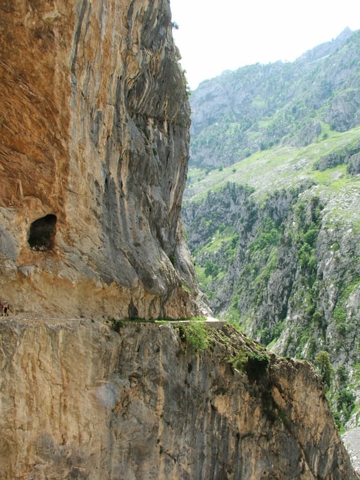
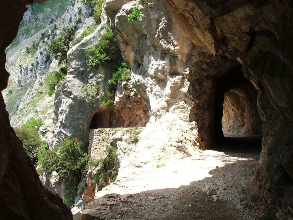
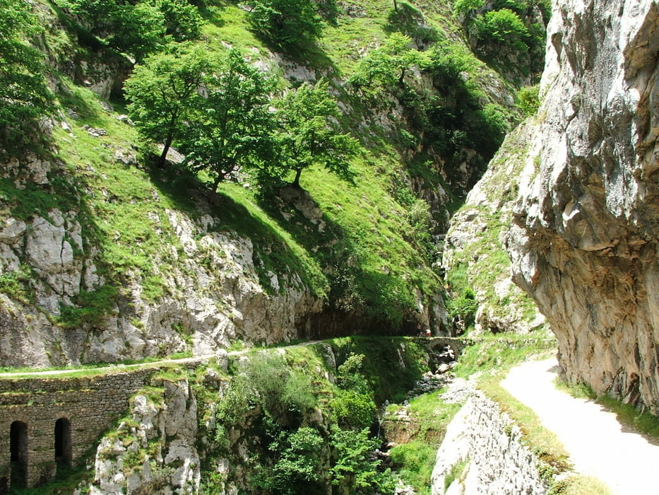
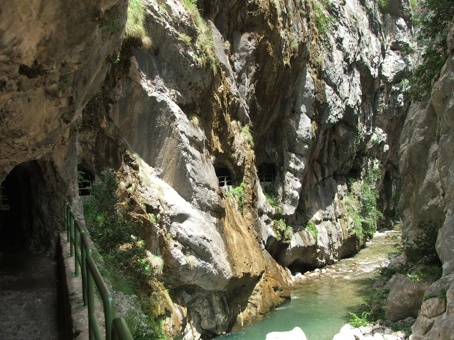
Von Poncebos durch die Schlucht des Río Cares nach Caín. Rückweg wie Hinweg.

Tour gallery

Tour map and elevation profile

  • Open Street Map
  • Google
Minimum height 99999 m Maximum height -99999 m Detailed view

More about the tour author

lothardomnik
Member since 2009

Send private message

Comments

AS 114, in Arenas de Cabrales auf die AS 264 nach Süden abbiegen, 6 km bis Poncebos.

GPS tracks

Trackpoints
  • GPX / Garmin Map Source (gpx) download
  • TCX / Garmin Training Center® (tcx) download
  • CRS / Garmin Training Center® (crs) download
  • Google Earth (kml) download
  • G7ToWin (g7t) download
  • TTQV (trk) download
  • Overlay (ovl) download
  • Fugawi (txt) download
  • Kompass (DAV) Track (tk) download
  • Track data sheet (pdf) download
  • Original file of the author (gpx) download

More about the tour author

lothardomnik
Member since 2009

Send private message
Share track
Add to my favorites
Remove from my favorites
Edit tags
My score
Rate
Track: Picos de Europa: Río Cares
Type: Mountain hiking
Distance: 10,9 km
Evaluated on:
Duration:
Day(s)
Hour(s)
Minute(s)
Score: Landscape Fun factor Fitness Technique