
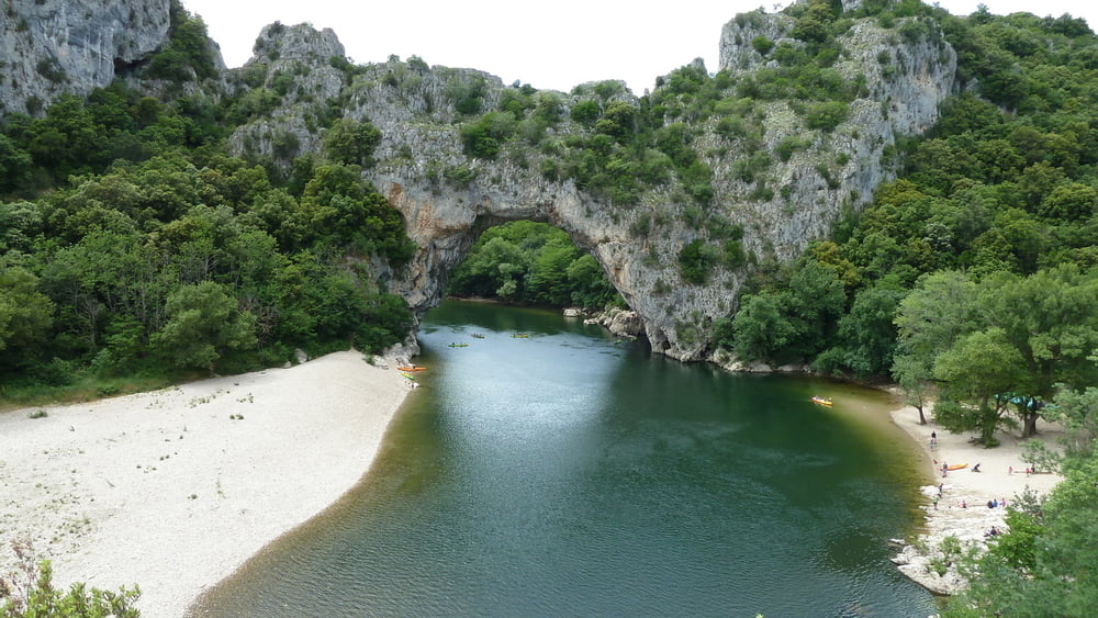

Schöne und nicht schwierige Wanderung vom Ort "Vallon Pont d'Arc" zur einer der Hauptsehenswürdigkeiten, dem Pont d'Arc. Unterwegs sind herrliche Aussichten auf die Schluchten der Ardeche zu sehen. Es handelt sich um eine Rundweg. Angegeben ist die reine Gehzeit. Zu empfehlen ist jedoch ein längerer Stop am Pont 'Arc mit Bademöglichkeit.
Der Rückweg vom Pont d'Arc zum Ort führt leider an der Hauptstrasse entlang.
Tour map and elevation profile
Minimum height 75 m
Maximum height 289 m
More about the tour author

|
123Vista |
Comments

Nach Vallon Pont d'Arc gelangt man über die Autobahn Lyon - Marseille, Abfahrt Montelimar-Nord, weiter in Richtung Aubenas. Über Le Teil, Villeneuve -de-Berg nach Vallon Pont d'Arc.
GPS tracks
Trackpoints-
GPX / Garmin Map Source (gpx) download
-
TCX / Garmin Training Center® (tcx) download
-
CRS / Garmin Training Center® (crs) download
-
Google Earth (kml) download
-
G7ToWin (g7t) download
-
TTQV (trk) download
-
Overlay (ovl) download
-
Fugawi (txt) download
-
Kompass (DAV) Track (tk) download
-
Track data sheet (pdf) download
-
Original file of the author (gpx) download
More about the tour author
|
|
123Vista |
Add to my favorites
Remove from my favorites
Edit tags
Open track
My score
Rate