Login

Forgot your login?

Cookies have to be accepted!
Your browser's cookie functionality is disabled. Please enable this functionality.

Not a member yet?

Register now
Login

Available for registred users only

Log in to use this feature.

Forgot your login?

Cookies have to be accepted!
Your browser's cookie functionality is disabled. Please enable this functionality.

Not a member yet?

Register now
Filter
Categories
Advanced filters
  • Distance (km)
  • Height
Save filters Reset filter

TrackRank

QRCode

Technical data

Distance36,4 km Height1589 m Way down1569 m Duration04:00 h:m Date12.06.2010
Scores Author Landscape Fun factor Fitness Technique

Statistics

1137 Views Scores 254 Downloads Average
Rate
  • Track data sheet
  • Directions
  • Downloads

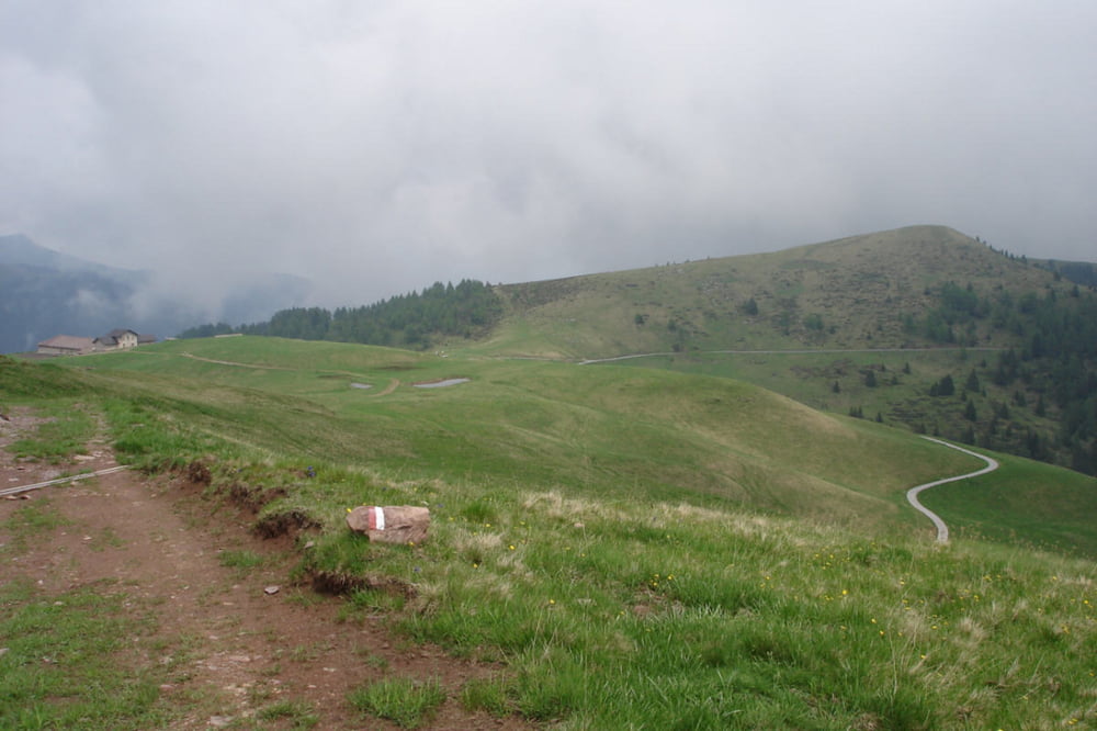
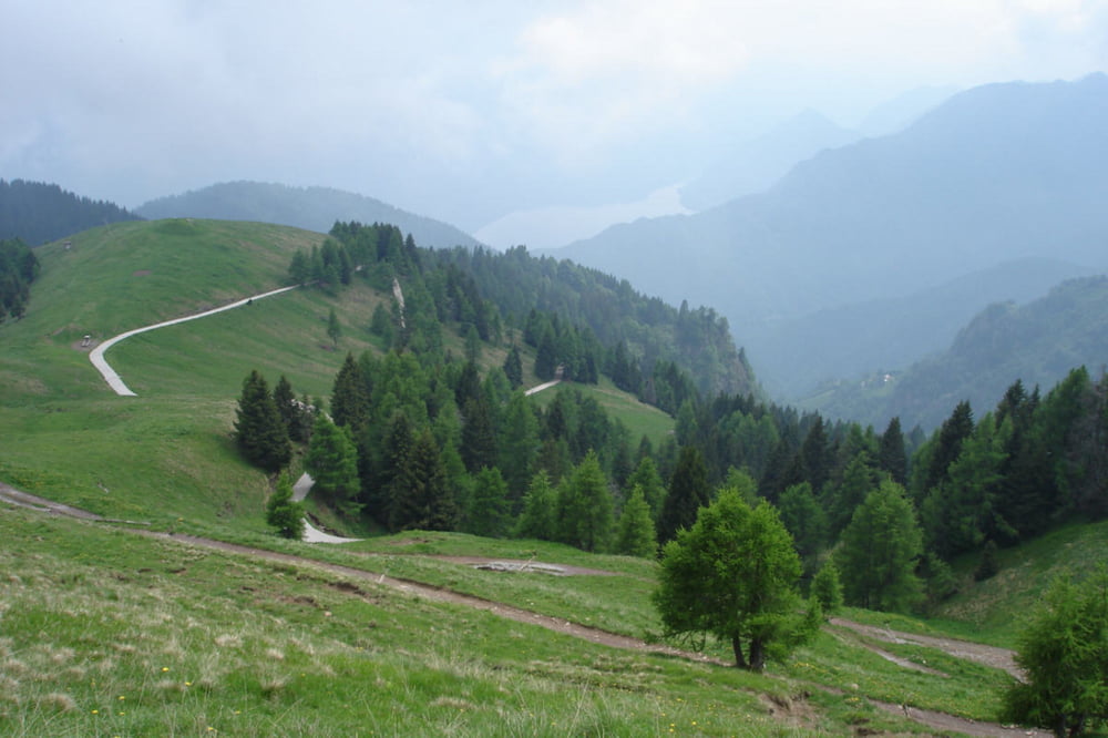
Lange Asphaltauffahrt (mir ist kein Auto begegnet) von Storo zur Wochenendhaussiedlung Faserno. Oben eine schöne Fahrt durch das Almgelände bei der Malga Vacil (1810m). Schöne Blicke ins Chiese-Tal und zum Idrosee. Fahrtechnisch unproblematisch. Am Ende ein langer Asphaltdownhill, der die Bremsscheiben zum glühen bringt :-).

Für Leute, die mal ein bisschen Abstand zum Trubel am Gardasee suchen.

Tour gallery

Tour map and elevation profile

  • Open Street Map
  • Google
Minimum height 399 m Maximum height 1945 m Detailed view

More about the tour author

unimei
Member since 2009

Send private message

Comments

velofahrer on 20.05.2011

Strada Chiusa!!!

Derzeit ist die hier beschriebene Auffahrt leider voll gesperrt: Auf ca. 1.000 m Höhe sind zwei Straßenanbschnitte durch einen großen Murenabgang unpassierbar. Die Straße wird wohl noch einige Wochen gesperrt bleiben, da die Aufräum- & Reparaturarbeiten erst begonnen haben (Stand: 19. Mai 2011).

Von Riva Richung "Val di Ledro", am Ledrosee vorbei nach Storo. Ca 40km, 1Std.

Auch die Anfahrt mit dem Auto am Ledrosee vorbei und durchs Valle d' Ampola ist landschaflich nicht uninteressant.

GPS tracks

Trackpoints
  • GPX / Garmin Map Source (gpx) download
  • TCX / Garmin Training Center® (tcx) download
  • CRS / Garmin Training Center® (crs) download
  • Google Earth (kml) download
  • G7ToWin (g7t) download
  • TTQV (trk) download
  • Overlay (ovl) download
  • Fugawi (txt) download
  • Kompass (DAV) Track (tk) download
  • Track data sheet (pdf) download
  • Original file of the author (gpx) download

More about the tour author

unimei
Member since 2009

Send private message
Share track
Add to my favorites
Remove from my favorites
Edit tags
My score
Rate
Track: Faserno
Type: Mountain bike
Distance: 36,4 km
Evaluated on:
Duration:
Day(s)
Hour(s)
Minute(s)
Score: Landscape Fun factor Fitness Technique