


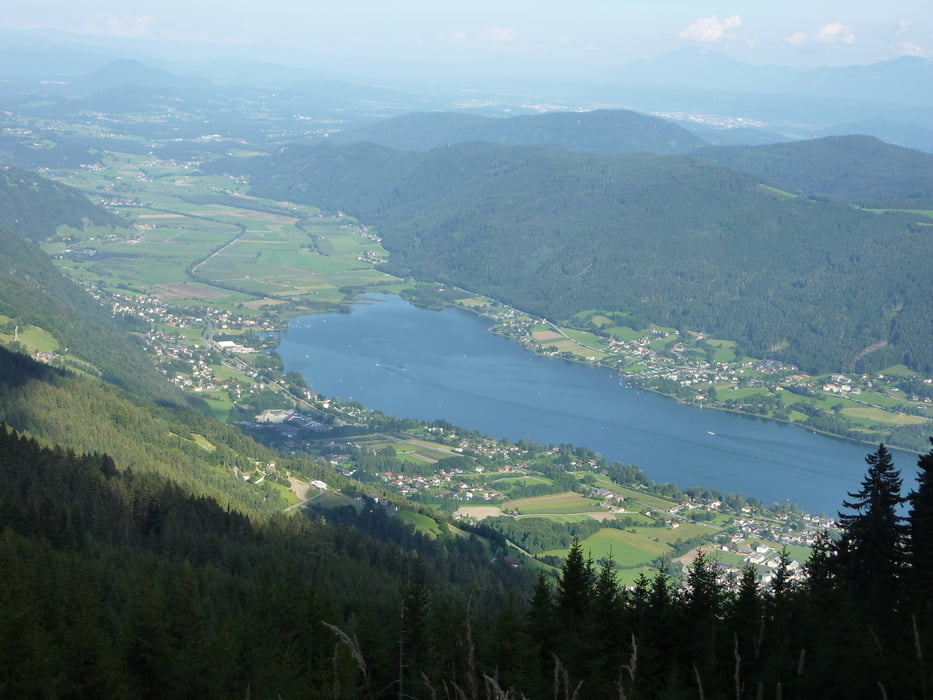
Die Tour startet in Steindorf. Zuerst geht's auf die Südseite des Ossiacher Sees über die Ossiacher Tauern.
Gemütlicher Aufstieg auf einen Forstweg, weiter über technisch teils anspruchsvolle Passagen über die Tauern bis zur Ruine Landskron. Von da rollen wir gemütlich über Annenheim, Bodensdorf zurück nach Steindorf.
Von da geht's auf die nördlichen Berge, zuerst über die Manessen und dann den Wanderweg Richtung Gerlitzen. Teilweise ist der Weg ein wenig ausgesetzt.
Den Weg fährt man mit einigen Abzweigungen bis zur Gerlitzen Alpenstraße (wenn die Lust und die Luft noch da ist geht's noch weiter zum Feuerberg) von da geht's talwärts bis nach Bodensdorf und da am See entlag wieder nach Steindorf.
Eine schöne Tagestour.
Tour gallery
Tour map and elevation profile
Minimum height 505 m
Maximum height 1763 m
More about the tour author

|
MPL |
Comments

GPS tracks
Trackpoints-
GPX / Garmin Map Source (gpx) download
-
TCX / Garmin Training Center® (tcx) download
-
CRS / Garmin Training Center® (crs) download
-
Google Earth (kml) download
-
G7ToWin (g7t) download
-
TTQV (trk) download
-
Overlay (ovl) download
-
Fugawi (txt) download
-
Kompass (DAV) Track (tk) download
-
Track data sheet (pdf) download
-
Original file of the author (gpx) download
More about the tour author
|
|
MPL |
Add to my favorites
Remove from my favorites
Edit tags
Open track
My score
Rate