


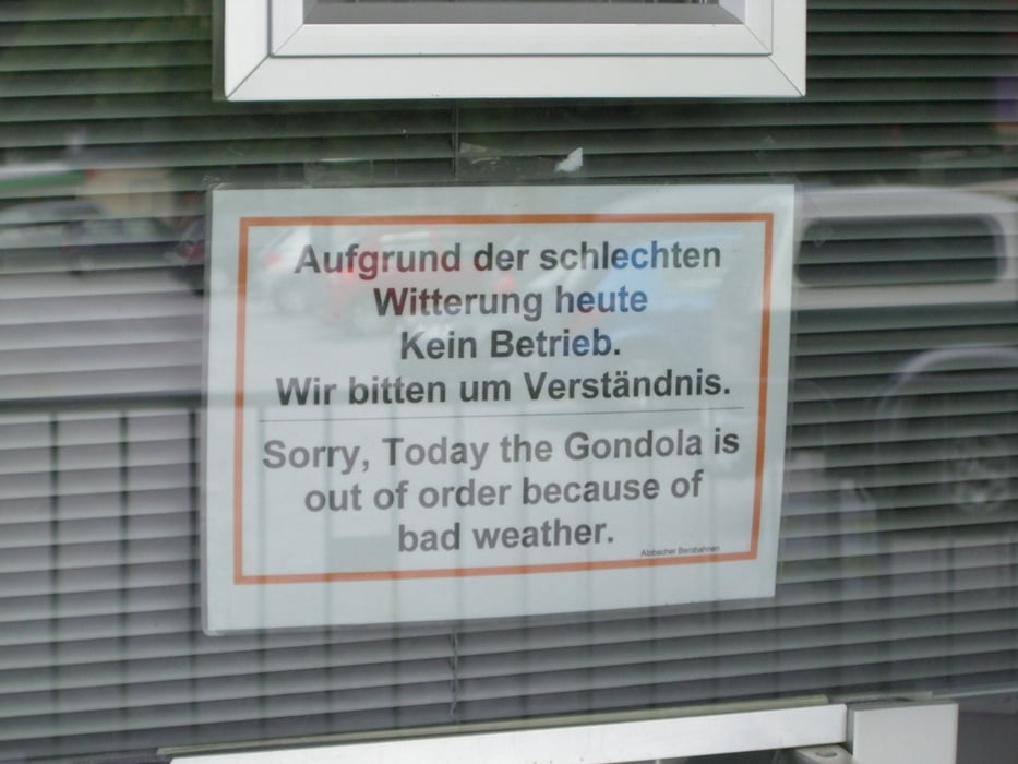
Die Tour beginnt in Alpbach und führt über Brunner Berg hinab nach Reith. Von dort kann man entweder mit der Seilbahn hoch zum Reither Kogel oder wie wir, der da Lift nicht in Betrieb war, über den Panoramaweg. Beim Panoramaweg handelt es sich um einen recht anständigen "Uphill" bei dem auf 7km ca. 550Hm kommen.
Oben angekommen hat man je nach Wetterlage einenschönen Blick ins Zittertal und kann auf einer überdimensionierten Sitzgelegenheit pausieren.
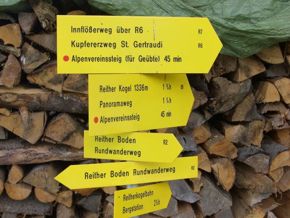
Weiter geht es über den Kerschbaumer Sattel zur Hechenblaikenalm und den letzten Anstieg zur Hochlindalm (1431m). Von dort geht es stetig bergab ins Aplbachtal. Ein kurzer Anstieg führt dan zurück zum Ausgangspunkt.
Further information at
http://www.alpbachtal.at/Tour gallery


Tour map and elevation profile
Minimum height 629 m
Maximum height 1438 m
More about the tour author
|
|
munz83 |
Comments

A12 Abfahrt 32 (Kramsach) => Brixlegg=>Reith i. Alpachtal=>Alpbach
GPS tracks
Trackpoints-
GPX / Garmin Map Source (gpx) download
-
TCX / Garmin Training Center® (tcx) download
-
CRS / Garmin Training Center® (crs) download
-
Google Earth (kml) download
-
G7ToWin (g7t) download
-
TTQV (trk) download
-
Overlay (ovl) download
-
Fugawi (txt) download
-
Kompass (DAV) Track (tk) download
-
Track data sheet (pdf) download
-
Original file of the author (gpx) download
More about the tour author
|
|
munz83 |
Add to my favorites
Remove from my favorites
Edit tags
Open track
My score
Rate