Login

Forgotten password?

Cookies have to be accepted!
Your browser's cookie functionality is disabled. Please enable this functionality.

Not a member yet?

Register now
Login

Available for registred users only

Log in to use this feature.

Forgotten password?

Cookies have to be accepted!
Your browser's cookie functionality is disabled. Please enable this functionality.

Not a member yet?

Register now
Filter
Categories
Advanced filters
  • Distance (km)
  • Height
Save filters Reset filter

TrackRank

QRCode

Technical data

Distance11,9 km Height1303 m Way down1297 m Duration07:00 h:m Date03.07.2010
Scores Author User Landscape Fun factor Fitness Technique

Statistics

1381 Views 1 Score 100 Downloads 4.00 Average
Rate
  • Track data sheet
  • Directions
  • Downloads

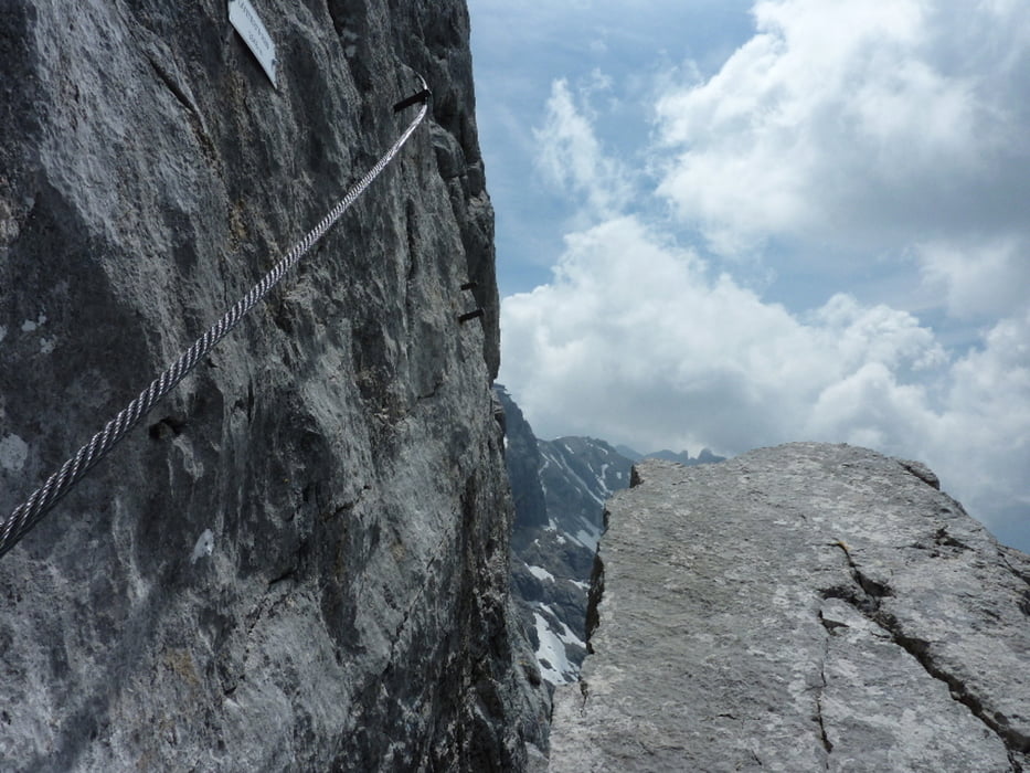
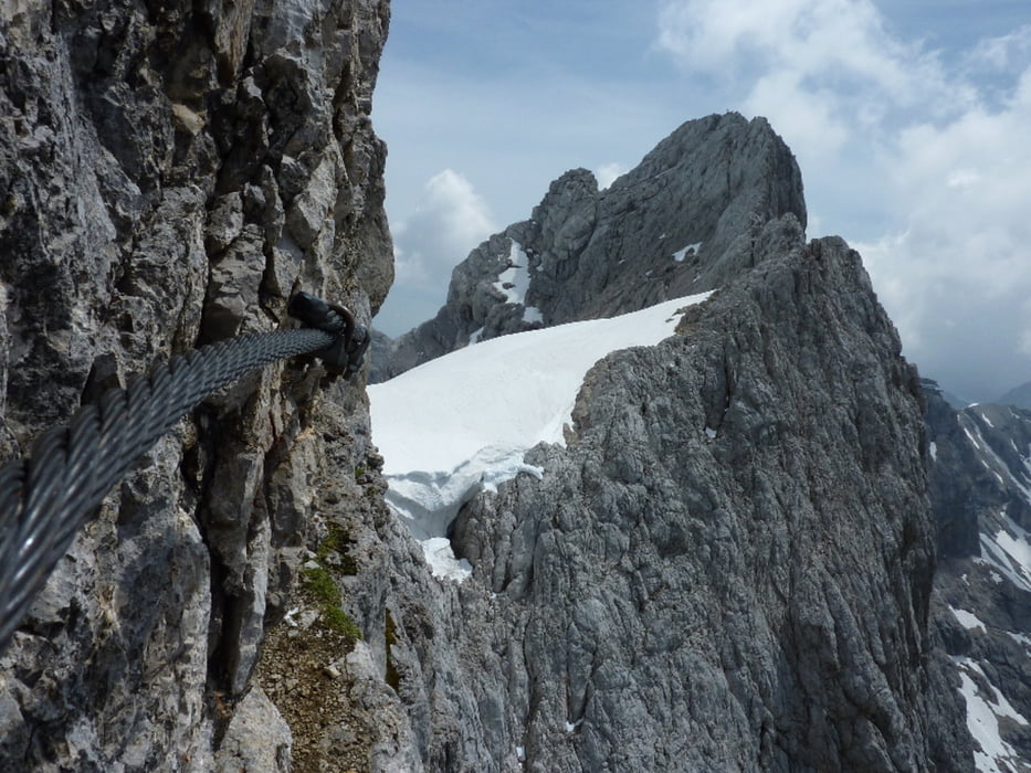
Von der Talstation zur Südwandhütte und weiter über Schneefelder zum Einstieg. Dann jeder Meter in der Wand ein Traum bis zur Seethalerhütte. Ohne Weizerl gleich weiter zum Einstieg "östlicher Schulter-Anstieg" . Dieser Steig zum Gipfel ist im Gegensatz zum Johann ein Spaziergang.

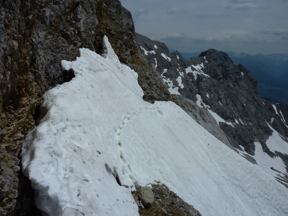
Abstieg über die Hunerscharte. 

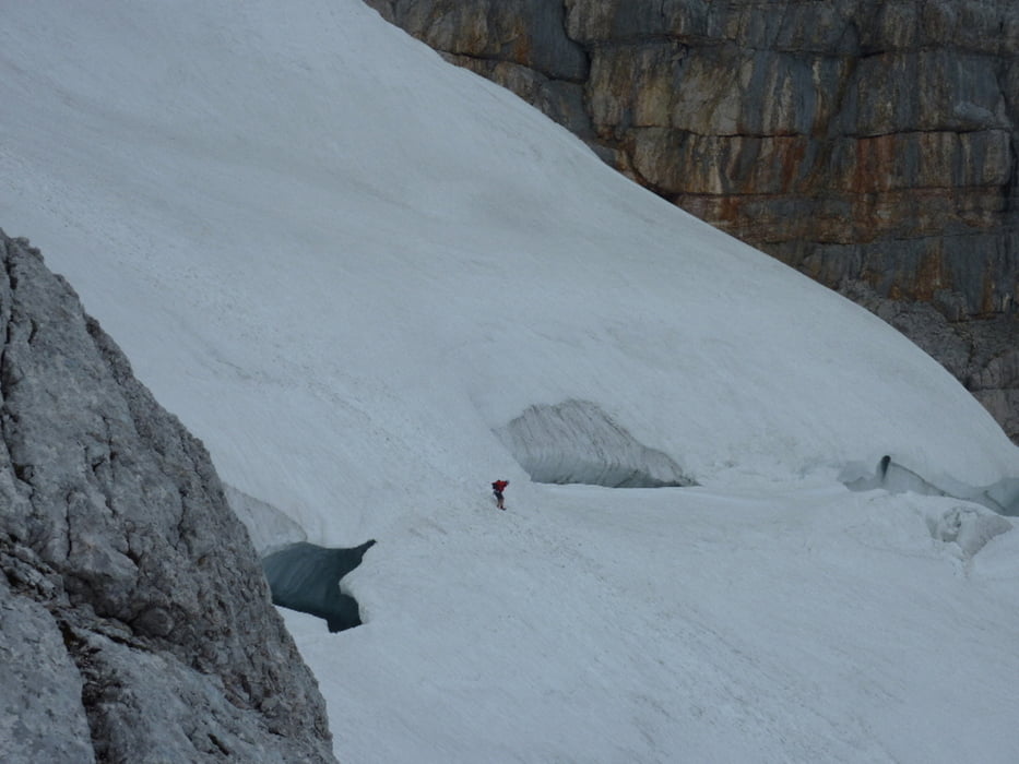
Achtung: Es sind Immer wieder gefährliche Schneefelder beim Aufstieg sowie beim Abstieg zu queren! Steigeisen + Pickel sind minimum Ausstattung.

Tour gallery

Tour map and elevation profile

  • Open Street Map
  • Google
Minimum height 1688 m Maximum height 2987 m Detailed view

More about the tour author

chp
Member since 2010

Send private message

Comments

GPS tracks

Trackpoints
  • GPX / Garmin Map Source (gpx) download
  • TCX / Garmin Training Center® (tcx) download
  • CRS / Garmin Training Center® (crs) download
  • Google Earth (kml) download
  • G7ToWin (g7t) download
  • TTQV (trk) download
  • Overlay (ovl) download
  • Fugawi (txt) download
  • Kompass (DAV) Track (tk) download
  • Track data sheet (pdf) download
  • Original file of the author (gpx) download

More about the tour author

chp
Member since 2010

Send private message
Share track
Add to my favorites
Remove from my favorites
Edit tags
My score
Rate
Track: Dachstein Johannsteig + östlicher Schulter-Anstieg 20100702
Type: Via ferrata
Distance: 11,9 km
Evaluated on:
Duration:
Day(s)
Hour(s)
Minute(s)
Score: Landscape Fun factor Fitness Technique