Login

Forgot your login?

Cookies have to be accepted!
Your browser's cookie functionality is disabled. Please enable this functionality.

Not a member yet?

Register now
Login

Available for registred users only

Log in to use this feature.

Forgot your login?

Cookies have to be accepted!
Your browser's cookie functionality is disabled. Please enable this functionality.

Not a member yet?

Register now
Filter
Categories
Advanced filters
  • Distance (km)
  • Height
Save filters Reset filter

TrackRank

QRCode

Technical data

Distance8,7 km Height1235 m Way down1239 m Duration06:00 h:m Date10.07.2010
Scores Author User Landscape Fun factor Fitness Technique

Statistics

1340 Views 1 Score 116 Downloads 4.00 Average
Rate
  • Track data sheet
  • Directions
  • Downloads

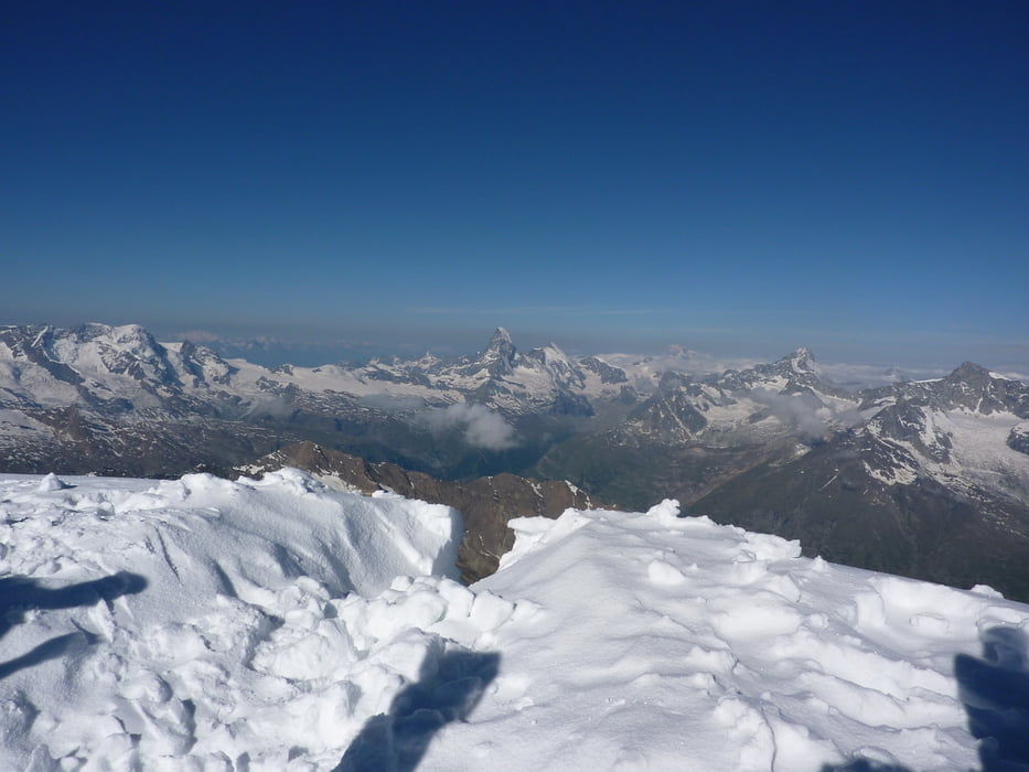
Einsteiger-Hochtour auf einen 4000er: den Alphubel.

Ausgangspunkt ist die Längfluhhütte im Skigebiet von Saas-Fee. Von dort geht es in NWW auf den Alphubel. Zurück auf dem gleichen Weg. Achtung Gletscherspalten...

Further information at

http://www.saas-fee.ch

Tour gallery

Tour map and elevation profile

  • Open Street Map
  • Google
Minimum height 3452 m Maximum height 4735 m Detailed view

More about the tour author

ckjh
Member since 2009

Send private message

Comments

Mit dem ÖV oder dem Auto nach Saas-Fee.

GPS tracks

Trackpoints
  • GPX / Garmin Map Source (gpx) download
  • TCX / Garmin Training Center® (tcx) download
  • CRS / Garmin Training Center® (crs) download
  • Google Earth (kml) download
  • G7ToWin (g7t) download
  • TTQV (trk) download
  • Overlay (ovl) download
  • Fugawi (txt) download
  • Kompass (DAV) Track (tk) download
  • Track data sheet (pdf) download
  • Original file of the author (gpx) download

More about the tour author

ckjh
Member since 2009

Send private message
Share track
Add to my favorites
Remove from my favorites
Edit tags
My score
Rate
Track: Alphubel
Type: Mountain hiking
Distance: 8,7 km
Evaluated on:
Duration:
Day(s)
Hour(s)
Minute(s)
Score: Landscape Fun factor Fitness Technique