


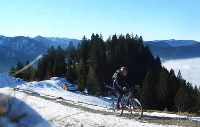
Geniale Feierabendtour mit steilem, schönen Serpentinenanstieg, toller Sicht, guter Alm und auch ein wenig Spaß runter . Dauer: 2:00h
Auffahrt: Durch Birkenstein geradeaus hoch. Der Weg ist eher Trail als Forstweg, meist steiniger Waldboden, sehr griffig, nachmittags auch mit Sonne. In der zweiten Hälfte wird es steil und in den schönen Serpentinen ein netter Sprint. Am Grat oben gehts dann eben in der Felswand noch zur Aiblinger Hütte unter dem Wendelstein wer will.
Abfahrt Auf dem gleichen Serpentinenweg, was aber sehr schön ist. Ganz unten, kurz vor Birkenstein kann man ein paar Meter noch Trailartiger fahren.
Einkehr: Kesselalm (gut), Aiblinger Hütte oder Klosterstüberl (sehr gut)
Further information at
http://www.martin-blum.de/bikeTour gallery
Tour map and elevation profile
Minimum height 773 m
Maximum height 1352 m
More about the tour author
|
|
martin.blum |
Comments

Autobahn A8 München-Salzburg, Ausfahrt Bad Aibling. Nach Süden Richtung Fischbachau. In Fischbachau parken bei Kloster (öffentliche Parkplätze).)
GPS tracks
Trackpoints-
GPX / Garmin Map Source (gpx) download
-
TCX / Garmin Training Center® (tcx) download
-
CRS / Garmin Training Center® (crs) download
-
Google Earth (kml) download
-
G7ToWin (g7t) download
-
TTQV (trk) download
-
Overlay (ovl) download
-
Fugawi (txt) download
-
Kompass (DAV) Track (tk) download
-
Track data sheet (pdf) download
-
Original file of the author (gpx) download
More about the tour author
|
|
martin.blum |
Add to my favorites
Remove from my favorites
Edit tags
Open track
My score
Rate