


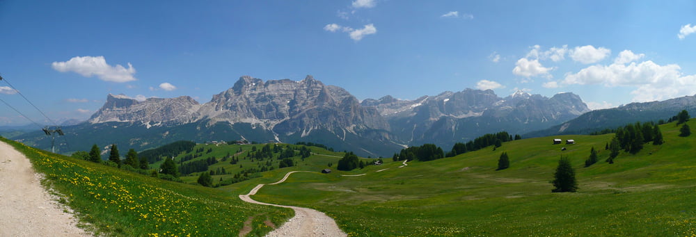
Wir sind die Sellaronda MTB Track Tour am Dienstag, den 29.Juni 2010 bei herrlichem Wetter gefahren. Start/Ziel war Wolkenstein.
Wir haben die Tour in der Relaxvariante! gemacht, d.h. wir sind 4x Lift gefahren.
- Danterceppies Lift (Wolkenstein)
- Col Alto Corvara Lift (Corvara)
- Braia Fraida Corvara (Corvara)
- Col Rodella Lift (Campitello di Fassa)
Die Nutzung dieser 4 Lifte hat die 3300 Bruttohöhenmeter auf 1250 Nettohöhenmeter schmelzen lassen und die gefahrene Distanz um etwa 7km verkürzt
Achtung! Rechtzeitig erkundigen ob die Lifte in Betrieb sind.
(vor allem ausserhalb der Hochsaison)
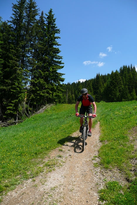
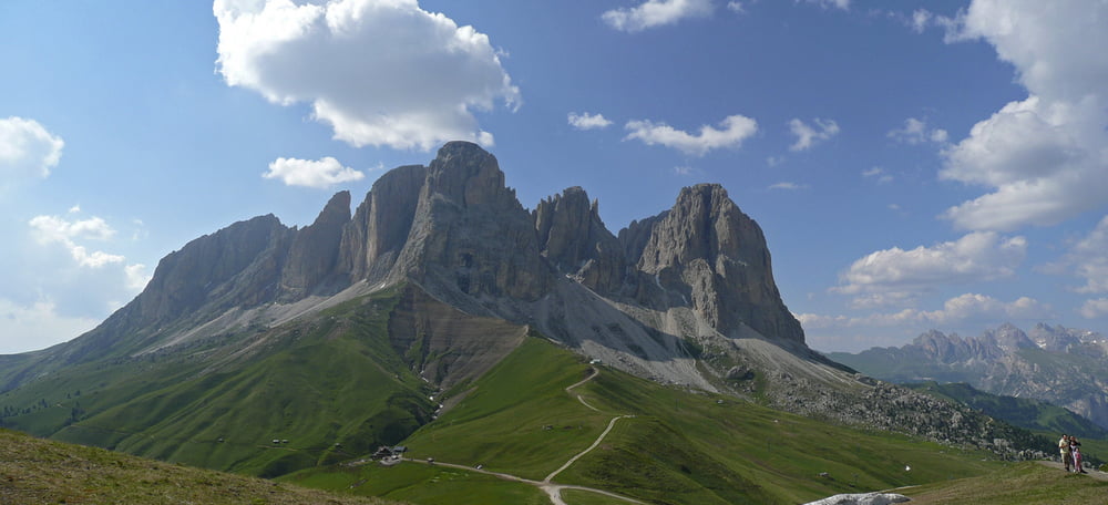
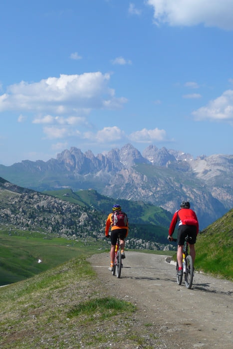
Die Tour ist wunderschön mit herrlichen Ausblicken und geilen (z.T. sehr steilen) Downhills!
Die Lifte sparen zwar ein paar Höhenmeter, eine Spazierfahrt ist es trotzdem nicht!
Vom Passo di Campolongo, über das Pordoi Joch, bis nach Campitello di Fassa haben wir weitgehend die Strasse genutzt, ebenso für die Abschlussabfahrt vom Sellajoch.
Da lässt sich's einfach geil heizen.
Auf der Pralongia Hütte und Rifugio des Alpes haben wir sehr gut gerastet.
Reine Fahrzeit: ca. 3,5h
Reine Fahrstrecke: ca. 61km
Further information at
http://www.ipernity.com/doc/nib/album/195187/showTour gallery
Tour map and elevation profile
Minimum height 1414 m
Maximum height 2386 m
More about the tour author
|
|
nib |
Comments

nach Wolkenstein über den Brenner ins Grödnertal.
Die Tour hat für uns in Wolkenstein gestartet.
GPS tracks
Trackpoints-
GPX / Garmin Map Source (gpx) download
-
TCX / Garmin Training Center® (tcx) download
-
CRS / Garmin Training Center® (crs) download
-
Google Earth (kml) download
-
G7ToWin (g7t) download
-
TTQV (trk) download
-
Overlay (ovl) download
-
Fugawi (txt) download
-
Kompass (DAV) Track (tk) download
-
Track data sheet (pdf) download
-
Original file of the author (gpx) download
More about the tour author
|
|
nib |
Add to my favorites
Remove from my favorites
Edit tags
Open track
My score
Rate