


Die Tour startet in Prutz bei der Raika; von hier auf der Strasse Richtung Kaunertal, Fendels; bei der nächsten Kreuzung Richtung rechts nach Fendels, dieser Strasse folgend bis zur zweiten Kehre; hier zweigt ein schöner Forstweg links ab, diesem folgend bis er wieder in einen asphaltierten Weg mündet; hier links bergauf und nun immer gerade aus; in einer Höhe von ca 1700Hm erreicht man das Ziel: s'Wiesele; nun weiter dem Forstweg bergab nach Kauns; man erreicht nun wieder die Hauptstrasse, die man nach rechts quert und die Strasse Richtung Kauns entlang bis nach Prutz zum Ausgangspunkt folgt;
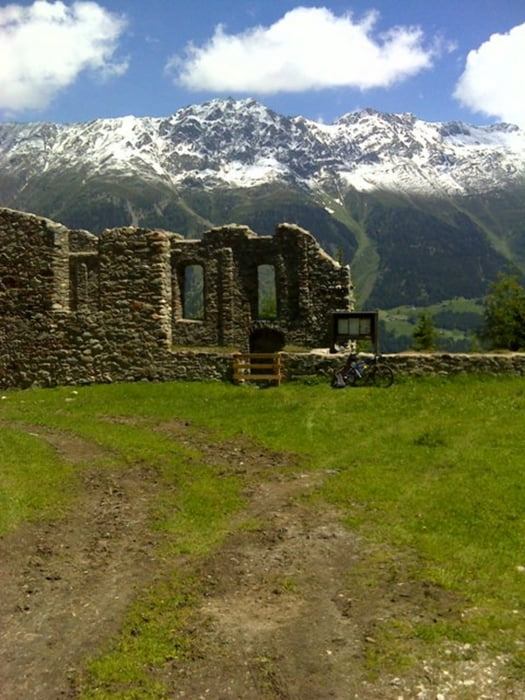
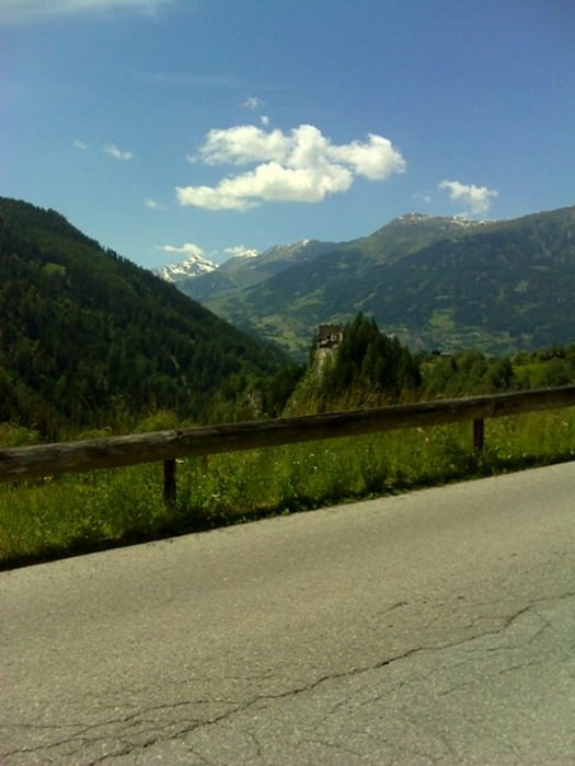
Tour gallery

Tour map and elevation profile
Minimum height 876 m
Maximum height 1765 m
More about the tour author

|
Maexchen144 |
Comments

Von Landeck kommend in Richtung Nauders Reschenpass bis nach Prutz! Startpunkt befindet sich bei der Ampel!
GPS tracks
Trackpoints-
GPX / Garmin Map Source (gpx) download
-
TCX / Garmin Training Center® (tcx) download
-
CRS / Garmin Training Center® (crs) download
-
Google Earth (kml) download
-
G7ToWin (g7t) download
-
TTQV (trk) download
-
Overlay (ovl) download
-
Fugawi (txt) download
-
Kompass (DAV) Track (tk) download
-
Track data sheet (pdf) download
-
Original file of the author (gpx) download
More about the tour author
|
|
Maexchen144 |
Add to my favorites
Remove from my favorites
Edit tags
Open track
My score
Rate