

Aufstieg: 2Stunden 10 Minuten
Abstieg: 2 Stunden 45 Minuten (bis zum Rif. Lagazuoi)
Abstieg über die Gallerie zum Falzaregopass 1 Stunde 45 Minuten
Zustieg:
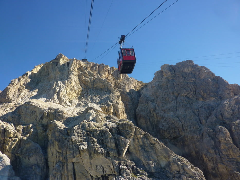
Von der Bergstation Lagazuoi-Seilbahn, 2752m abwärts in die Forcella Lagazuoi.
Zuerst über Weg Nr.20 bis zur nächsten Weggabelung und über Weg 20b zum Bivacco della Chiesa kurz unterhalb des Einstieges.
Abstieg:
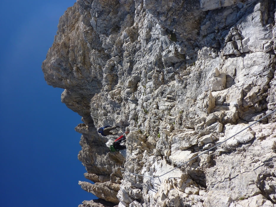
Vom Gipfel über den gut gesicherten Klettersteig hinunter in die Selletta Fanis und südseitig über einen Weg und Steigspuren. Knapp vor den Bivacco den Weg 20b nach rechts folgen um den Lagazuoi Grande zur Forc. Travenanze und über den Weg 401 zum Rif. Lagazuoi.
Von dort aus erfolgt der Abstieg durch die 1100 Meter lange Galleria del Lagazuoi.
Taschenlampe nicht vergessen.
Further information at
http://www.dolomiten.orgTour gallery


Tour map and elevation profile
Minimum height 2126 m
Maximum height 2994 m
More about the tour author
|
|
harald07071 |
Comments

Von Cortina d`Ampezzo zum Falzaregopass.
Großer Parkplatz an der Talstation der Seilbahn zum Lagazoui
GPS tracks
Trackpoints-
GPX / Garmin Map Source (gpx) download
-
TCX / Garmin Training Center® (tcx) download
-
CRS / Garmin Training Center® (crs) download
-
Google Earth (kml) download
-
G7ToWin (g7t) download
-
TTQV (trk) download
-
Overlay (ovl) download
-
Fugawi (txt) download
-
Kompass (DAV) Track (tk) download
-
Track data sheet (pdf) download
-
Original file of the author (gpx) download
More about the tour author
|
|
harald07071 |
Add to my favorites
Remove from my favorites
Edit tags
Open track
My score
Rate