


Die Tour ist eine Tageswanderung, die auch im Winter durchgeführt werden kann (Dann sind aber Gamaschen hilfreich)
Der Weg führt über eine alte Römerstraße, die Segovia mit Meaccum verband, auf den Pass Puerto Fuenfría. Von dort geht es weiter nach Westen auf den Cerro Minguete und den Montón de Trigo. Der Abstieg führt am Grat entlang (an der Grenze der Comunidad de Madrid und Castilla y León) zum Pass Collado de Marichiva.
Die angegebene Zeit bezieht sich auf eine Schneewanderung, ohne Schnee dürfte die Zeit geringfügig abweichen.
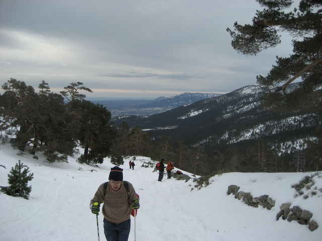
Tour gallery
Tour map and elevation profile
Minimum height 1068 m
Maximum height 2158 m
More about the tour author
|
|
Earendil |
Comments

Mit dem Bus der Linie 684 kommt man für 3,25 € (Stand 1/07) von Moncloa nach Cercedilla. Die Tour beginnt an der Bushaltestation.
Alternativ kann man auch mit der Cercanías anreisen, deren Station liegt unweit der Busstation.
Autos können beim Wegpunkt Info Fuenfría geparkt werden
Alternativ kann man auch mit der Cercanías anreisen, deren Station liegt unweit der Busstation.
Autos können beim Wegpunkt Info Fuenfría geparkt werden
GPS tracks
Trackpoints-
GPX / Garmin Map Source (gpx) download
-
TCX / Garmin Training Center® (tcx) download
-
CRS / Garmin Training Center® (crs) download
-
Google Earth (kml) download
-
G7ToWin (g7t) download
-
TTQV (trk) download
-
Overlay (ovl) download
-
Fugawi (txt) download
-
Kompass (DAV) Track (tk) download
-
Track data sheet (pdf) download
-
Original file of the author (gpx) download
More about the tour author
|
|
Earendil |
Add to my favorites
Remove from my favorites
Edit tags
Open track
My score
Rate