


Start: Reichenbach
- mit dem Postbus von Reichenbach zur Griesalp ( Kosten ca. 14 SFR )
- Wanderung von der Griesalp zur Bundalp ca. 1 Stunde
- Übernachtung auf der Griesalp ( Übernachtung + Halbpension ca. 55 SFR )
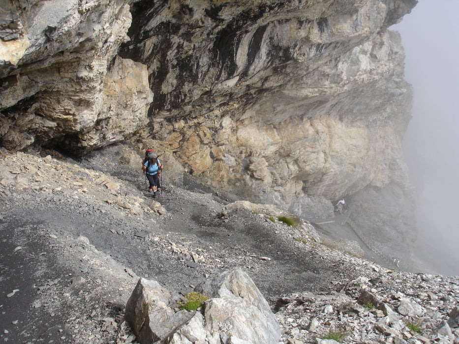
- von der Bundalp zur Blüemlisalp ca. 1000 Hm / ca. 3 Stunden
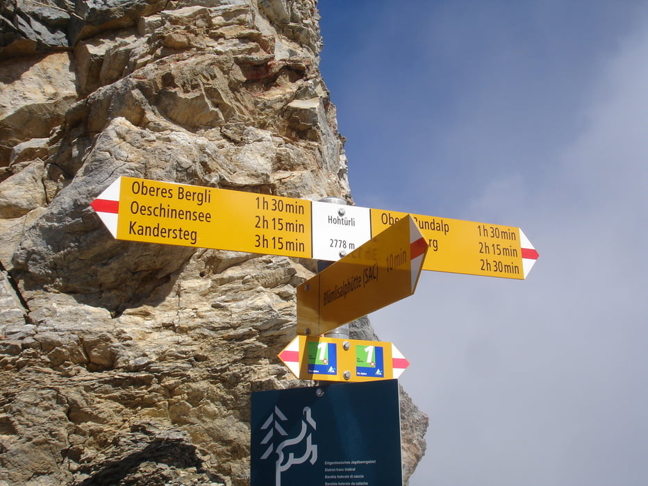
- Blüemlisalp / Hohtürli zum Oeschinensee ca. 1300 Hm Abwärts / ca. 4 Stunden
- vom Oeschinensee zur Bergstation Gondelbahn ca. 40 Minuten
- Gondelfahrt nach Kandersteg ( Kosten 15 SFR )
- mit dem Zug von Kandersteg nach Reichenbach ( Kosten ca. 13 SFR )
Ziel: Reichenbach
Tour gallery


Tour map and elevation profile
Minimum height 712 m
Maximum height 2837 m
More about the tour author
|
|
WeissManuel |
Comments

GPS tracks
Trackpoints-
GPX / Garmin Map Source (gpx) download
-
TCX / Garmin Training Center® (tcx) download
-
CRS / Garmin Training Center® (crs) download
-
Google Earth (kml) download
-
G7ToWin (g7t) download
-
TTQV (trk) download
-
Overlay (ovl) download
-
Fugawi (txt) download
-
Kompass (DAV) Track (tk) download
-
Track data sheet (pdf) download
-
Original file of the author (gpx) download
More about the tour author
|
|
WeissManuel |
Add to my favorites
Remove from my favorites
Edit tags
Open track
My score
Rate