


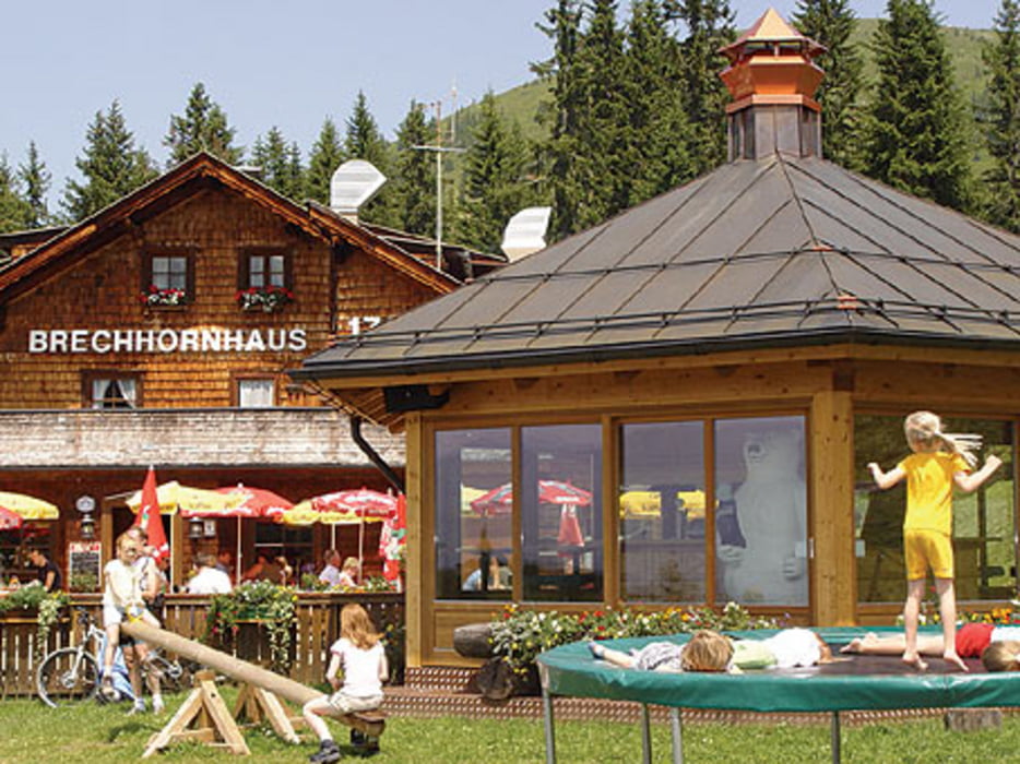
Nette kleine Runde, die ohne große Schwierigkeiten Anfangs Asphalt und später auf Forststraße zum Brechhornhaus führt. Startpunkt an der Talstation der (alten) Gondelbahn direkt neben dem Ortskern von Werstendorf. Hier zuerst auf einer kleinen Asphaltstrasse bergan, später problemlos auf einem Forstweg. Rastmöglichkeiten auf der Fleidingalm, oder wenige Höhenmeter weiter (10 Minuten) auf dem Brechhornhaus.
Die Abfahrt vom Brechhornhaus Richtung Aschau führt ebenfalls über Forststraße. Im Spertental angekommen (direkt neben der Talstation Kiwest) auf der Asphaltstraße weiter stetig bergab nach Kirchberg. Dort auf dem Radweg immer an der Ache (links der Ache) entlang über Brixen zurück nach Westendorf. Sehenswert ist hier der ein oder andere Bauernhof.
Tour gallery
Tour map and elevation profile
Minimum height 764 m
Maximum height 1665 m
More about the tour author
|
|
Ruinenpeter |
Comments

GPS tracks
Trackpoints-
GPX / Garmin Map Source (gpx) download
-
TCX / Garmin Training Center® (tcx) download
-
CRS / Garmin Training Center® (crs) download
-
Google Earth (kml) download
-
G7ToWin (g7t) download
-
TTQV (trk) download
-
Overlay (ovl) download
-
Fugawi (txt) download
-
Kompass (DAV) Track (tk) download
-
Track data sheet (pdf) download
-
Original file of the author (gpx) download
More about the tour author
|
|
Ruinenpeter |
Add to my favorites
Remove from my favorites
Edit tags
Open track
My score
Rate