


Date: August 5, 2010
Start: 1200 m (Rabischschlucht entrance)
Finish: 660 m (Obervellach village)
Highest point: 1200 m (Rabischschlucht entrance)
Lowest point: 660 m
Total ascent: 100 m
Total descent: 560 m
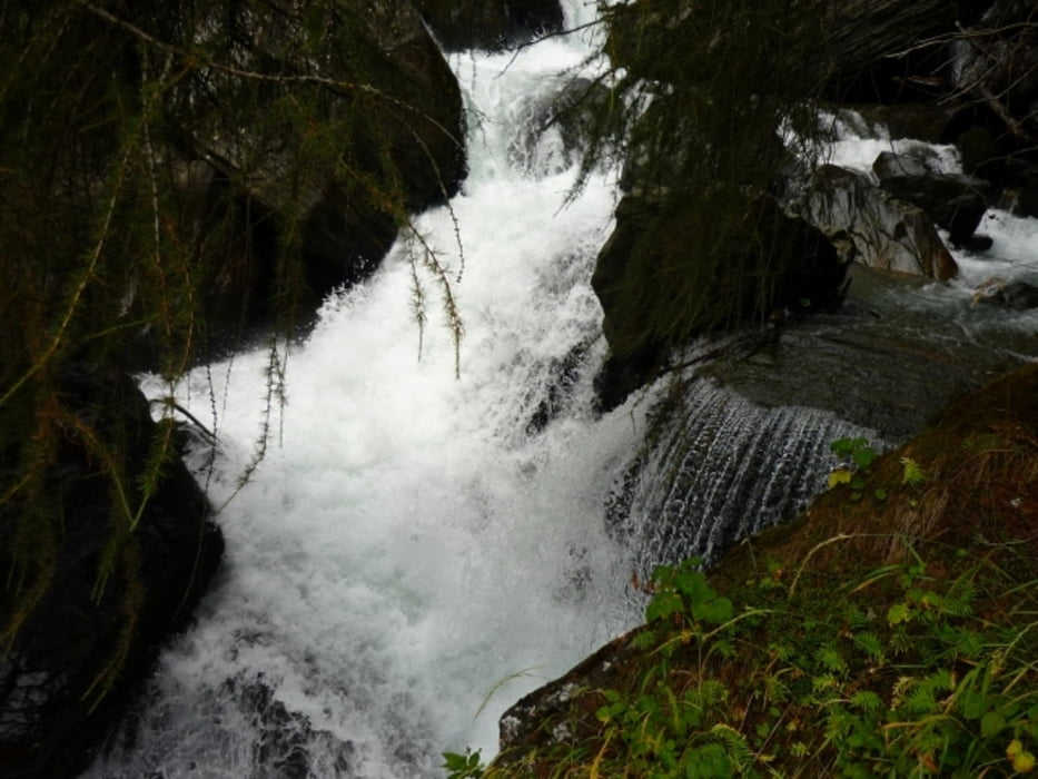
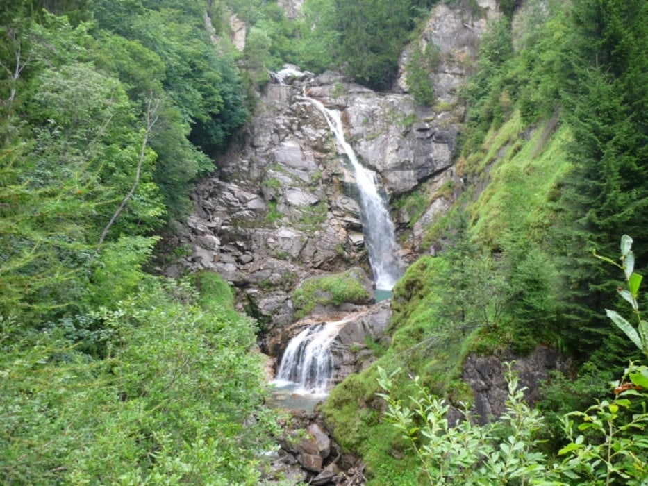
Non slippery shoes recommended!
More information:
http://www.nationalpark-hohetauern.at/de.aspx/Articles/View/347
Further information at
http://www.beepee.hu/v/ausztria2010/heiligenblut/schlucht/Tour gallery

Tour map and elevation profile
Minimum height 677 m
Maximum height 1223 m
More about the tour author
|
|
beepee |
Comments

Places where you can eat and drink:
Obervellach village
Route:
1. from Obervellach village (Seilbahnplatz), take a bus that goes to Mallnitz, get off at 'Rabisch' stop
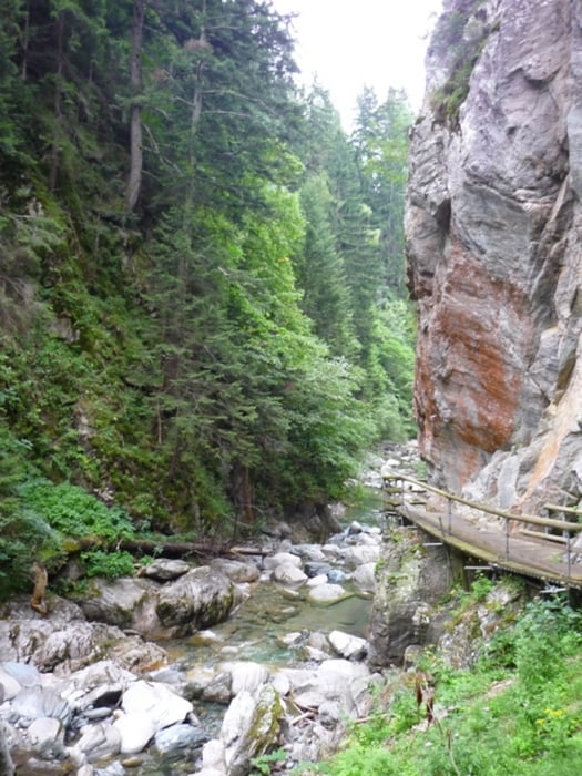
2. from the bus stop, go right, cross the bridg, then turn right to the entrance of Rabischschlucht
3. follow the marked trail
4. follow the signs towards Groppensteinschlucht
5. walk out to the main road, then turn left into the village and walk back to the bust stop
You can park your car at the bus stop, or you can drive to the exit of Groppensteinschlucht and park there.
I looked all over the internet to find if any of the gorges (Schluchts) are one-way, but found no information about that. In fact, on the Nationalpark Hohe Tauern website, they indicate that walking time downhill takes about 3 hours, uphill about 4 hours. So we figured it is OK to walk downhill.
However, at the upper entrance of Groppensteinschlucht, there were signs: please do not walk downhill in the gorge. Since we were already there, we did not care of the signs, and there were not so many people anyway (we met only 1 group of about 10 people).
When there are more people it can be very disturbing to walk the opposite way, because in some places the path is very narrow. So if you want to be totally 'legal', do this tour the other way around, from Obervellach uphill - then you can take the bus down or simply walk back along the road or other trails.
GPS tracks
Trackpoints-
GPX / Garmin Map Source (gpx) download
-
TCX / Garmin Training Center® (tcx) download
-
CRS / Garmin Training Center® (crs) download
-
Google Earth (kml) download
-
G7ToWin (g7t) download
-
TTQV (trk) download
-
Overlay (ovl) download
-
Fugawi (txt) download
-
Kompass (DAV) Track (tk) download
-
Track data sheet (pdf) download
-
Original file of the author (gpx) download
More about the tour author
|
|
beepee |
Add to my favorites
Remove from my favorites
Edit tags
Open track
My score
Rate