


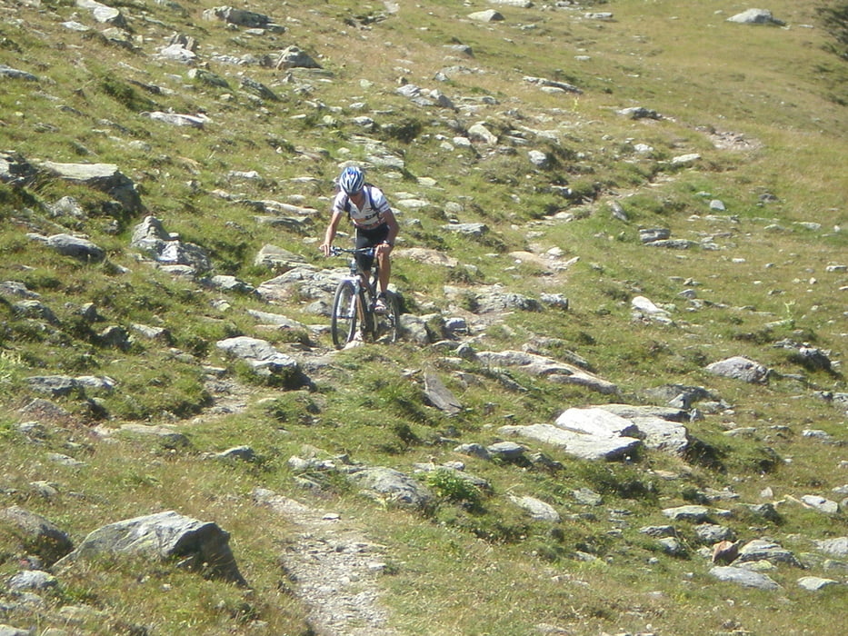
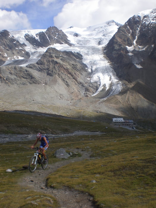
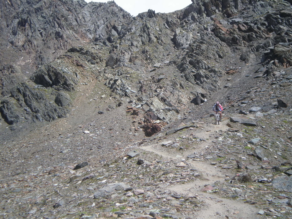
De tocht zijn wij begonnen bij camping Cima Piazzi, hierna zijn wij afgedaald richting Le Presse over asfalt. Hier kun je door het dal richting Passo d' Alpi (2463m) waarna je uit komt op de Gavia pas. Hier zijn wij een stukje over het asfalt richting Santa Catharina gereden. Na de 4de haarspeldbocht zijn wij een schotterpad in gegaan, om daarna via een wandelpad naar Santa Catharina af te dalen, deze moest veel gelopen worden. Beter is het om een andere wandelpad of via het asfalt naar het dorp te rijden. Vanuit Santa Catharina zijn we richting Rifugio Alfergo Forni gereden dit is geheel asfalt met redelijk steile stukken ertussen. Hierna zijn we over de schotter via de schotterweg naar Rifugio Pizzini gereden, in het begin zitten vrij steile stukken daarna is de klim goed te doen. Het laatste stuk naar Passo Zebru (3005m) gaat over een single track ongeveer 300hm waar de laatste 100 hm gelopen van moeten worden. Vanaf de Pas krijg je een prachtige afdaling eerst over een singletrack ongeveer 6km en gaat over in een schotterpad. Deze daal je ongeveer 8km af tot je een bordje van Fantelle tegenkomt. Hier pak je de single track omhoog en kom je in Fantelle en gaat over in asfalt weg, deze weg rijd je tot je de eerste haarspeld bocht tegenkomt hier kun je via een schotterpad en singletracks in bormio terechtkomen.
Tour gallery
Tour map and elevation profile
Minimum height 952 m
Maximum height 3007 m
More about the tour author
|
|
michelvdijk |
Comments

GPS tracks
Trackpoints-
GPX / Garmin Map Source (gpx) download
-
TCX / Garmin Training Center® (tcx) download
-
CRS / Garmin Training Center® (crs) download
-
Google Earth (kml) download
-
G7ToWin (g7t) download
-
TTQV (trk) download
-
Overlay (ovl) download
-
Fugawi (txt) download
-
Kompass (DAV) Track (tk) download
-
Track data sheet (pdf) download
-
Original file of the author (gpx) download
More about the tour author
|
|
michelvdijk |
Add to my favorites
Remove from my favorites
Edit tags
Open track
My score
Rate